 This was actually my 3rd time to Zion National Park. First time I was 12. The 2nd time was when George & I were on our honeymoon. Now it's 22 years later. The rocks haven't changed a lot, but the park and I certainly have. For one thing, you can forget about driving in the park. From April-October, Zion Canyon Scenic Drive is open to shuttle buses only.
There are 9 shuttle stops. We stopped at most of them to take pictures and go on a few trails.
At the Temple of Sinawava, we took a 2-mile stroll along the Riverside Walk. At the far end of Zion Canyon, it follows the Virgin River through the Zion Canyon to the Narrows. The Narrows are closed now because of the possibility of flash floods, but I wouldn't be interested anyway. (Are you kidding? Me? Wade in the river where the water is ice-water cold*, the current is fast and the rocks are slippery? No-thank-you-very-much! )
This was actually my 3rd time to Zion National Park. First time I was 12. The 2nd time was when George & I were on our honeymoon. Now it's 22 years later. The rocks haven't changed a lot, but the park and I certainly have. For one thing, you can forget about driving in the park. From April-October, Zion Canyon Scenic Drive is open to shuttle buses only.
There are 9 shuttle stops. We stopped at most of them to take pictures and go on a few trails.
At the Temple of Sinawava, we took a 2-mile stroll along the Riverside Walk. At the far end of Zion Canyon, it follows the Virgin River through the Zion Canyon to the Narrows. The Narrows are closed now because of the possibility of flash floods, but I wouldn't be interested anyway. (Are you kidding? Me? Wade in the river where the water is ice-water cold*, the current is fast and the rocks are slippery? No-thank-you-very-much! )
Next trail was the short but steep Weeping Rock Trail. It ends at a rock alcove with dripping springs and a pretty view.
The last hike we took was from Zion Lodge on the Lower Emerald Pool Trail. We'd done this one when we were there in June, 1990. The waterfalls didn't look nearly as inviting as when the temps were baking over 100!
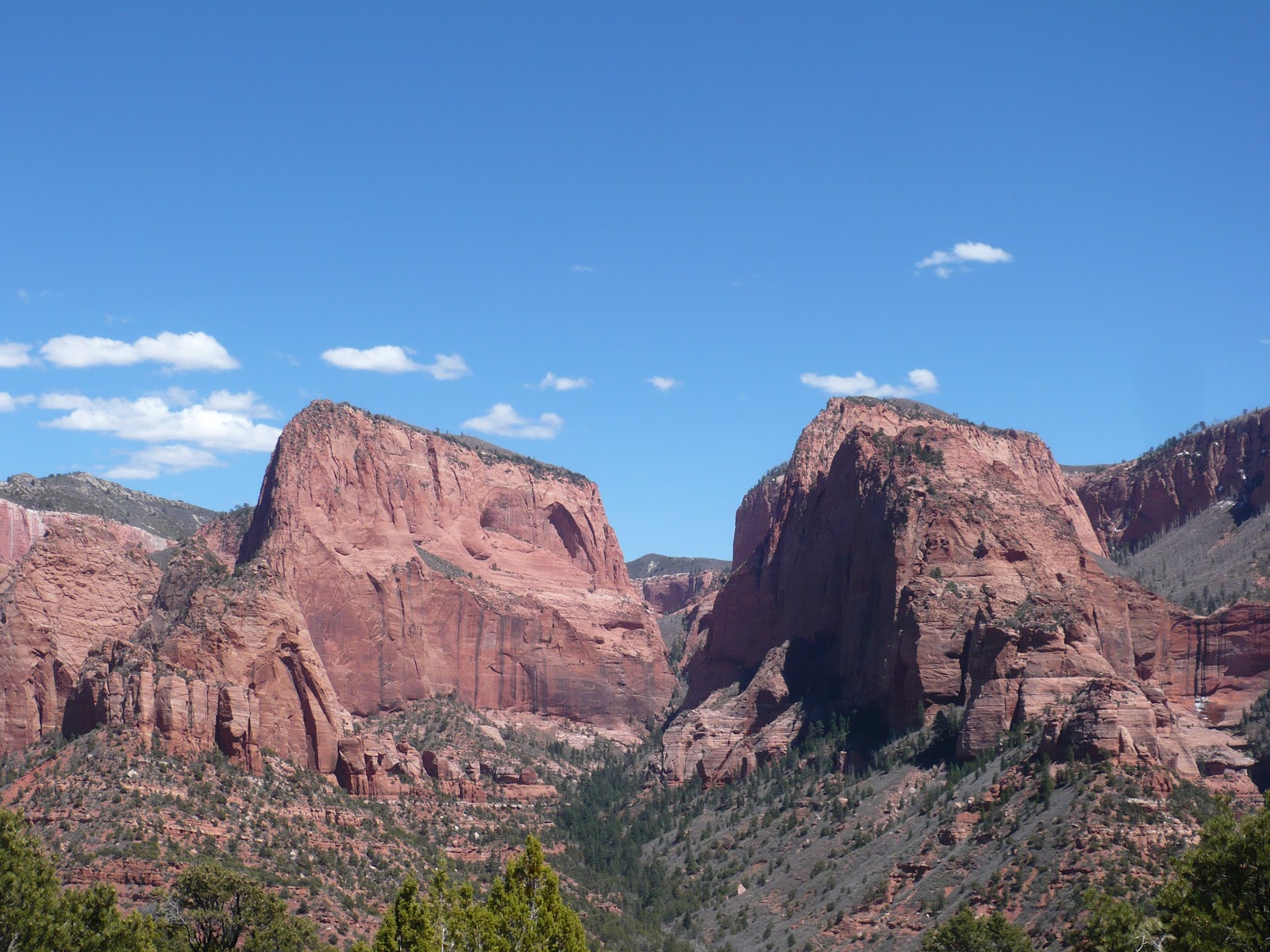
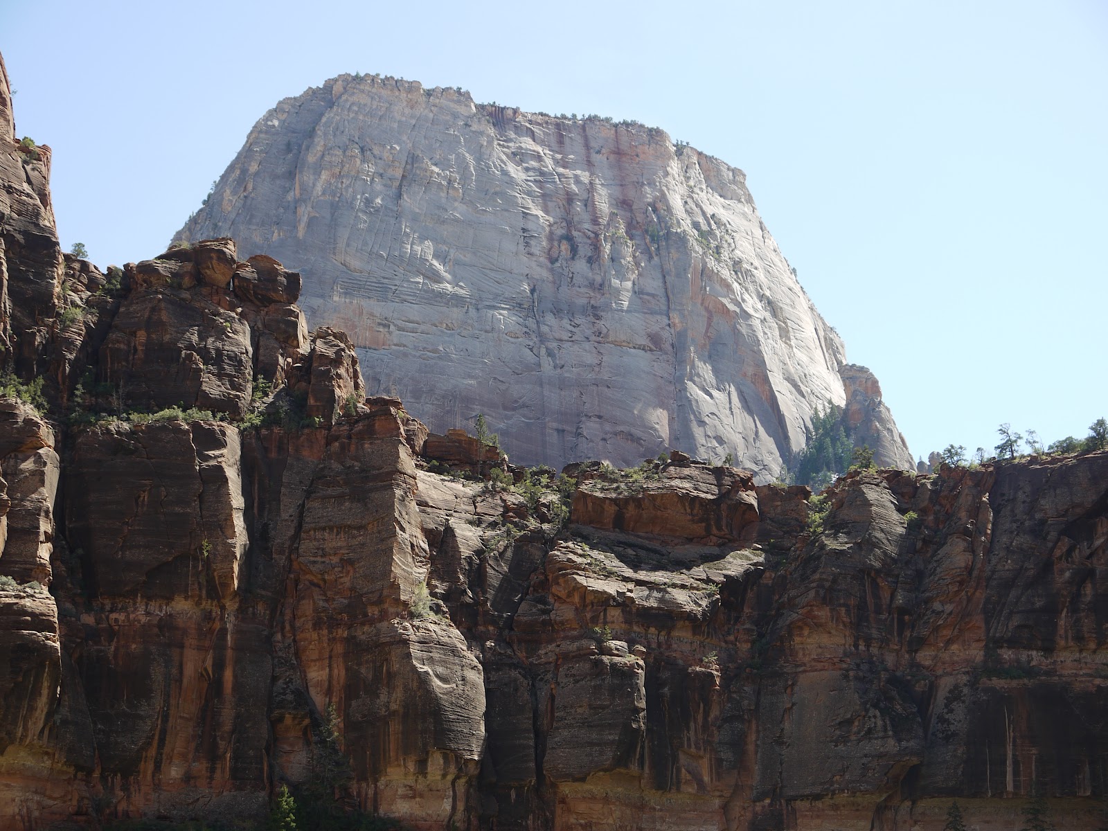
All these trails were paved, and there were lots of people, even in April. We saw most of the major peaks of Zion (except for Checkerboard Mesa which is near the East Entrance), but I have trouble remembering which is which--except for The Great White Throne, of course.
*How do I know the temperature of the water? I stuck my fingers in the river. Then I poured some water from George's water bottle (which has ice in it) on my hand. Ergo, the river water is ice-cold!
.JPG)
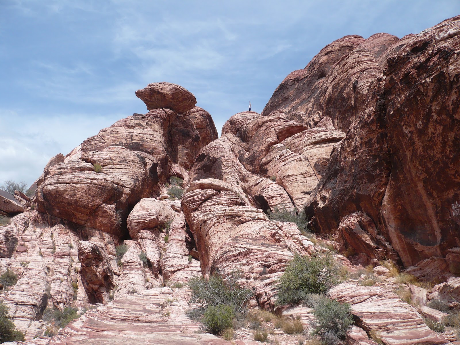
.JPG) Although I went to high school in Las Vegas, I really don't care much for the place--but we keep coming back since it's on the way to or from so many other places. (There's also a 1000 Trails park here, which really helps the budget.) First time we were here, we went to Red Rock Canyon on a weekend, with scads of other people! I negotiated for a return visit on a weekday.
Although I went to high school in Las Vegas, I really don't care much for the place--but we keep coming back since it's on the way to or from so many other places. (There's also a 1000 Trails park here, which really helps the budget.) First time we were here, we went to Red Rock Canyon on a weekend, with scads of other people! I negotiated for a return visit on a weekday. 


.JPG)


.JPG)


.JPG)
.JPG)


.JPG)

.JPG)

.JPG)


.JPG)

.JPG)


.JPG)