November 30, 2014

11/27/2014 - Sequoia and Kings Canyon Natl Parks

Yes, if you look at the date, you'll see it was Thanksgiving Day in America. Honestly, there's no rule that says you have to stay home and eat turkey. Sometimes you just want to do something else. Instead of preparing and eating a big bird in a small RV, we went to see the big trees. (Actually, they call them "giants", and they are really, really, really tall!)  

Every other time we were in the area, the weather at Sequoia and Kings Canyon National Parks wasn't very cooperative.  Generals Highway had always been closed because of snow.  But the Sierra Nevadas only have 25% of the snowpack they did last year, so the road's still open. We headed for the park(s).  Kings Canyon is adjacent to but bigger than Sequoia.  Three times as many people go to Sequoia.  (I'm sure you wanted to know that.)

The majority of both parks is wilderness, so most visitors see the parks by just driving the Generals Highway through the giant trees, stopping to get up close to some of the really famous ones.  We came in the Ash Mountain Entrance and drove to the Foothills Visitor Center for info and passport stamps.
The old road went under Tunnel Rock.  We walked under the rock and through the tunnel (or is that redundant?)  
At the Hospital Rock viewpoint we swapped cameras with another couple.  (I really hate trying to figure out someone else's camera.  It's like getting out of someone else's car.  You know there's a door handle, but it's not where the one your hand automatically goes to, and you feel sort of stupid.)  I have no idea why it's called "Hospital Rock"--apparently no one else does either because I couldn't find a reference to it in my admittedly cursory Google search.
If you think there's a problem seeing the forest because of the trees, you should try taking a picture of these trees.  If you try to show how tall the trees are, you can't see the base of the tree.  If you get the bottom, you cut off the top. If you want people for comparison, they don't need to smile.
  
Near the Giant Forest Museum, we took the turnoff to Moro Rock, not having a clue what we were getting into.  It's a granite dome with amazing views of the western half of Sequoia NP and the Great Western Divide.  The trail to the top was built by the CCC in the 1930s.  It has 400 steps with a 300' elevation gain, so a lot of people just get back in their cars and leave.  (I don't think George read that part on the sign, which was fine because I wanted to climb.)
 
Four hundred is a LOT of stairsteps!  You climb and climb and then climb some more, and every time you think you're getting near the top, you turn a corner and there are more steps.  The view is great though so you keep going!
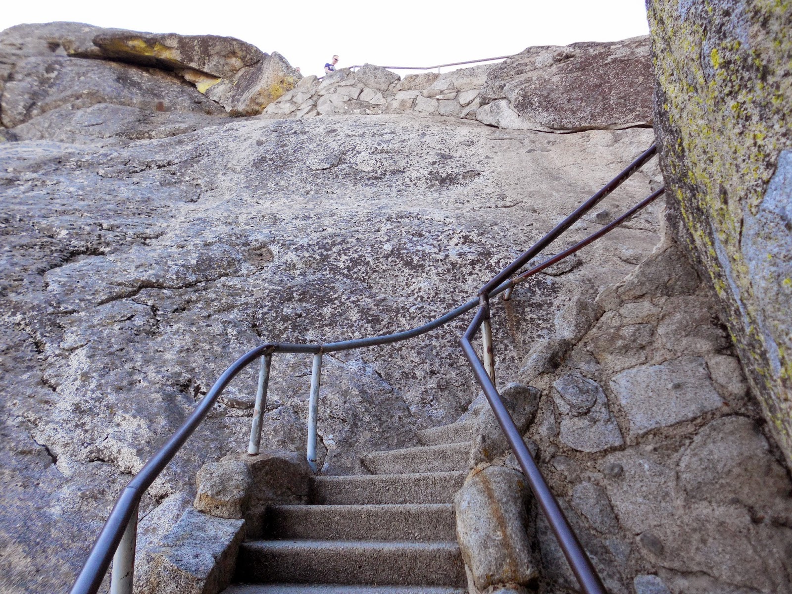
Sometimes you have to wait for someone else to come down.  (That's okay--you can catch your breath, from the exercise and the scenery!)
This trail was my favorite part of the whole park.  I don't think the CCC guys put in handrails and guardrails... but I'm grateful to whoever did!
When we finally got to the top, there's a wicked step down that I didn't notice because I was busy looking at the top of the rock.  Typical klutzy me with the sloppy ankles took a step down, fell, rolled from ankle to hip to shoulder, just like I'd practiced or something.  (No, I don't know who these guys are.  And no, they didn't fall, even not looking where they stepped. And no, I wasn't sore later--thanks for asking.)
Top of Moro Rock:
View from the top--Great Western Divide on one side and the road we came up on the other:
What goes up must come down.  Oops! forgot this part!  (It's better when you don't look all the way down at once because straight down wouldn't be much fun.)
We headed back to the Generals Highway. (That would be Civil War Generals Sherman and Grant.  They each have trees named after them too.  Wonder why they have to share the highway?) We stopped a few times to get up close to some of the giants. I'm pretty puny next to the roots of the Buttress Tree. I wonder what it sounded like when this guy fell down??
One of the giant sequoias is so big you can drive a truck through it.  Okay, not a semi, but Tunnel Tree has a base diameter of 21', with an 8' high tunnel.  
The General Sherman Tree is the largest.  It's not the tallest, nor does it have the longest circumference, but it's the heaviest.  My high school physics class was a long time ago, but I'm pretty sure we didn't calculate the weight of trees.  Probably the height, but not the weight.  So rather than try to do it myself, the NPS website says there's 52,500 cubic feet (1486.6 cubic meters) of wood.  (I figure they ought to know.)  So here's the General Sherman Tree, top and bottom--use your imagination to put it together.   
Amazing that all those huge trees came from little cones like this!  
More pictures here:  Sequoia National Park
I want to come back and check out more of Kings Canyon next time, including General Sherman's tree.

October 30, 2014

10/8/14 - North Cascades NP

It’s interesting how people will go all over the place to play tourist but ignore the tourist attractions in their own backyard.  North Cascades National Park is only about 100 miles from our house.  The whole Cascade Loop is about 400 miles of some of the prettiest and most rugged scenery in the states.  We've been on most of it at one time or another, just passing through.  Highway 20 goes right through North Cascades National Park, but we’d never stopped at the Visitor Center.  

We headed east at Burlington, through a bunch of little towns along the Skagit River:  Sedro-Wooley (fun name), Concrete, Rockport, Marblemount, then on to Newhalem, and the park Visitor Center.  Since it looks like a big lodge (or a national park visitor center), it’s right at home among the trees and mountains.
They, of course, have a video and a bunch of exhibits.  We partook.  Behind the lodge is a big patio where we had lunch before we took the short (300 feet defines short!) Sterling Munro Trail.  It’s just a boardwalk through the woods with a surprising view of the Picket Range at the end, although I suppose I wouldn't have been surprised if I'd read the information sign.
Those mountains are only 10 miles away, but there are no trails up there. It’s October—but that’s not new snow, that’s one of the many glaciers in this park.  When it comes to mountains, I like the jagged slopes and sharp peaks of the Cascades.  As I tried to tell that guy on the Blue Ridge Parkway near the Great Smoky Mountains, OUR mountains are taller, more rugged, prettier--and newer.
 
Ross Lake National Recreation Area bisects the park along the Skagit River and north around Ross Lake to Canada.  On the map the NRA part is a little brighter shade of green between the paler green of the NP.  I’m not sure if it’s truly an overlap, or if they’re separate government properties.  Either way, sounds a bit like overkill to me.  George got two passport stamps for the price of one. 

We parked at the Gorge Overlook and took another short walk to see the gorge and dam.  Check out the color of the water--that's not a filter on my camera.
Back at the highway, we crossed the road to cross the creek to see the waterfall. 
Diablo Lake is an amazing color.  I thought the first time I saw it that the bright color was because the water so cold, but that’s not what the sign says.  (If you can't read it, it says the color comes from "rock flour" created by glaciers is suspended in the water and reacts with light.)
You can learn a lot of geology at national parks.  Classrooms are better than in any science class I ever took.

Diablo Dam is run by Seattle City Light, and there are tours of the dam and ferries on the lake in the summer.  Since it’s October, you know the rest...
We did a little backtrack to take the turnoff and crossed the dam to the other side of the lake.  I liked driving on the dam.
They were doing some roadwork farther east so we opted to do the rest of the park another day (another season).  I want pictures from the Washington Pass Overlook, and I know we’ll be back again. 
There night be a few more pictures on Flickr, but I think I used most of them in the blog. Sometimes I get greedy that way. North Cascades Natl Park 

September 30, 2014

9/27/14 - Falls Park, Post Falls, ID

If you're I-90 heading east out of Washington, the first town across the state line is Post Falls.  If you're paying attention and look quickly, you can see Post Falls.  George pointed it out to me, but I missed it...more than once.  Hence, the day-trip to Falls Park.

There was some construction going on, so we missed the turn downtown.  The GPS didn't care much for the blocked streets.  George wasn't expressing loving thoughts about the GPS.  NOT the first time that's happened.

George hadn't been to the Falls in about 50 years, so the park was as new to him as it was to me. There are paths that wind around, and signs that point out the historical stuff, like this headgate from the 1880s. They've done a good job of preserving and explaining the little that's left.

The original dam across the Spokane River was built of logs in 1871, but that's been gone for a long time.  Then in 1906 this north channel dam was rebuilt of concrete.  Within two years they'd built two more dams across the middle and south channels as well as a power house.  Pretty good with only man and horse power.
Down river is Avista High Bridge, which goes across to the Avista Island.  George said they used to go over to the island and picnic, but the power company that owns the dam has it closed off now.
There's a pretty little fishing pond at the park too.  
This is the base for the control gate for the cable mill power plant.  I'm sure you wanted to know that.
For a few more pictures of Falls Park, click here.  I like the snowberries.  

September 29, 2014

9/17/14 - Coulee Corridor NSB

George's grandfather worked on Grand Coulee Dam back in the 1930s and he'd occasionally mention that the family went there when he was a kid, George and I have driven Highway 2 a lot between Seattle and Spokane, but never made the detour to the dam.  He decided while we were staying in Quincy, we'd go see it.

The Coulee Corridor National Scenic Byway goes from Omak to Othello, about 150 miles. We picked it up at Soap Lake and drove north 50 miles to the dam.
Lenore Lake
Perhaps you don't know what a coulee is, and what makes this one grand?  Well, I didn't either. (Apparently the definition depends on what state you're in, kind of like the difference between BBQ in different states.)  Since this is eastern Washington, it refers to the dry channels formed by glacial drainage of the Scablands quite some time ago. You have to have an appreciation of bare rocks, but the Grand Coulee does make for some wicked looking scenery.  There are rugged canyons, fascinating rock formations and lots of lakes.  This one is Blue Lake.
Sun Lakes-Dry Falls State Park marks the divide between the Lower and Upper Grand Coulee.  This 400 foot high cliff used to be a 3.5 mile wide waterfall!  Niagara Falls is pretty big--this one was four times that size. Now most of the water is gone and little Park Lake at the base and the rest of the Sun Lakes are all that's left of the Ice Age Wonder.
Dry Falls
There used to be a trail from the parking lot down to the lake, but it's closed off.  There's a road down to the campgrounds and boat launch, as well as a private resort in the state park.
I really like the way the basalt curves in this chunk of canyon.
Steamboat Rock State Park is at the north end of Banks Lake. From a distance it looks like an island, but it's actually on a peninsula.
     
We got to Grand Coulee Dam about 2:30.  After school starts, they do more tours on weekends than during the week.  This is Monday, and we msised the afternoon tour by minutes. The Laser Light Show didn't start until 8:30 so we were too early for that. (Maybe I can get George to come back sometime within the next 25 years; we can camp somewhere closer, get there earlier and stay later.)

At the Visitors Center we saw the movie and wandered the halls looking at the exhibits. Besides info on building the dam, there are displays about Woody Guthrie, commemorative stamps and post cards, a WattMeter, a Rosie the Riveter Quilt, and my personal favorite, a collection of water jugs with water from all the states and territories.
 
 
Check out the picture in the middle--that's the queen and 50 princesses from the 1951 Washington State Apple Blossom Festival symbolically pouring water over the dam.  Only in America...
 
On the way home, we stopped at the Gehrke Windmill Garden in Grand Coulee.  There are more than 120 whirly gigs built by Emil Gehrke.  They were in his yard until he died, then moved to a city park. Pity about the fence, but apparently even whimsy has to be protected from vandals and thieves.

A word about advance planning.  I'm usually pretty good about preparing for a trip before we leave.  Not only did I not check times for the tour and Laser Show, but I didn't realize until later that had we driven another mile past the dam, George could have gotten another Passport stamp.  Oh, well, one more reason to go back!

More pictures here:  Coulee Corridor Natl Scenic Byway