December 31, 2010

12/31/10 – Death Valley NP

Death Valley’s not terribly convenient to go visit.  We decided to stay in Pahrump, NV, and I found an RV park there, and booked us for a week.  Pahrump has a few casinos, and a few RV parks, the ubiquitous Walmart—and more tattoo parlors per capita than anywhere I’ve ever been. 
We went to Death Valley on New Year’s Eve (day).  Several of the roads were closed because of the recent rains.  All the roads were still showing signs of flooding.  It’s really odd to be in Death Valley and see signs that say “flood damage ahead”. 
We went up on Zabriskie Point to see the Badlands, wrinkles of mountains in shades of brown and tan.  It was sooooo cold!  We were bundled up in coats and hats and scarves.  Wasn’t this why we left Washington?  Isn’t Death Valley supposed to be one of the hottest places in the US????  Apparently not in December…
We went to the Visitor Center and the ranger suggested we backtrack to Dante’s Point to view the Valley.  It looks down on Badwater Salt Flats (282’ below sea level), but it looked like water was reflecting in the sun.  Maybe it was a mirage?  So we went to Badwater—and found it really was standing water!
We went on the one-way Artist’s Drive, and saw the colored hills of the Artist’s Palette. 
Then we headed to Scotty’s Castle for the tour.  The tour itself is what they call a “living history” tour, with the docent dressed up in early 20th century clothes, pretending to be as an a friend of Scotty, telling anecdotes of the people in the house as if he were just telling stories about friends.   George really liked that part. 
It was getting dark as we left Scotty’s Castle, so there wasn’t time to make the sidetrip to the dunes.  I had wanted to hike to the “Devil’s Golf Course”, but it was underwater.
I’d go back.  Not in winter, and definitely not in summer. Maybe in the springtime...

Link to more pictures of Death Valley

December 29, 2010

12/27/10 – Calico Ghost Town

This is a San Bernadino County Park and we stayed in the RV campground there.   I thought I went here when I was a kid but Charlotte didn’t think so.  I'm sure she's right.
Quincy (a friend from work that we visited when we were in Menifee) told me that I’d be disappointed because it was pretty run down (isn’t that the definition of “ghost town”?)
The campsite I’d reserved was uninhabitable—if such a thing can be said for a dirt parking place.  The rains and flooding hit again, and dug out a big trench at one end of our assigned campsite.  We moved to another one and then checked out the town in the dusk—did it again the next morning in early light to see what I’d missed the night before.  No crowds either time.  
Original flooded campsite
It was different than I’d expected because it wasn’t strictly ghost town.  Well, it was, but it isn’t.  It was an old silver mining town that was bought in the ‘50s by Walter Knott, the same Knott of Knott’s Berry Farm fame.  He glitzed it up to make it park-like, then donated it to the county. 
It was all decorated up for Christmas, and I thought it was pretty.  There are feral cats there—dozens of them!  Pick a color and you could find it.  They’re pretty leery of people, but the rangers like them because they keep the rodents down.  Good point.

December 26, 2010

12/23/10 – Joshua Tree NP

It rained hard for two days.  Southern California has been hit hard by unusual weather this year, but mostly we’d avoided it.  I guess it was time to just hunker down in the storm.
After two days in a 27’ travel trailer, it was time to get OUT and about.  Joshua Tree NP is dedicated to the preservation of the Joshua Tree, a form of yucca. 
You could really tell where the flash floods had been, and there was still lots of sand over the roads.  We went in at the south entrance to the Cottonwood Visitor Center.  The ranger suggested a couple of must-do hikes and the drive. 
We took the hike to Cottonwood Spring—followed an Indian family and ended up almost lost.  (I should have known better; the Indian developers I know never get it right the first time!)  I have no idea where the trail was supposed to go, but we followed the family up a sandy wash, and then when they went one way we went the other direction.  By this time we’d figured out they really didn’t know where they were going…we didn’t either but our way was more interesting.  It lead through some big rocks and then onto another wash.  Eventually we decided we were on a really long trail that would go for miles, so we turned back.

We drove the main road to the West entrance.  Besides the Joshua Trees (which I grew up seeing in Las Vegas), there are some other pretty interesting cacti.  The ocotillo were dormant, so just looked like clusters of sticks.  We walked through the Cholla Cactus Garden and avoided getting attached by the spines of the "Teddy Bear Cholla" aka "Jumping Cholla".
My absolute favorite were the hikes we took through the huge stacks of rocks all piled randomly on top of each other!  There's one called "Skull Rock" that does really look like a skull.  We had lunch at the Jumbo Rocks Campground, then hiked up to Arch Rock and on to the Barker Dam.  It was getting dark, so we had to hustle back to the parking lot. 

December 22, 2010

12/19/10 – Salton Sea

Next stop on the 1000 Trails tour was 1000 Trails Palm Springs, which is actually in Palm Desert, CA.  We were booked there through the 26th (11 days); after Christmas it was booked solid!  We got there the day before the heavy rains started on the other side of the mountains.  We heard later that where we’d been at Menifee Lakes got flooded (all those canals!) and a lot of folks came to Palm Springs to get away from the water.  It was getting close to Christmas, so we decorated the awning and the palm tree on our campsite.
Salton Sea is a California State Recreation Area.  It was caused by accidental flooding in the early 1900’s, and because “the place to go” in the ‘50s.  Parts of it haven’t changed since then at all.  I had seen a very interesting photo essay on the web, and thought I’d like to replicate some of those pictures.  We drove around the little town of Bombay Beach, but when George thought I was going to get us shot, we decided it would be better to leave...
 There are supposed to be gazillions of birds, and we saw some, but not nearly as many as I wanted.  Once again I realized that I hate taking pictures of water; that stupid horizon keeps tipping if you don’t hold the camera absolutely level!  And when there’s a glare on the water it’s hard to WHAT you’re shooting!  Mountains are much easier—no one expects them to be flat.
We drove down to the mud pots—a big hole that burps and gurgles like Yellowstone.  The really weird ones were the mud volcanoes. 
We also hiked out to the Dos Palmas Oasis.  (I didn’t know there were wild palm oases in California!)  They’re interesting, but certainly not beautiful.  I’m not big on palms with “beards”—the unclipped dead fronds that layer down the tree, which can house snakes and rats and other critters.  On the way back we stopped at a Date Ranch, sampled about 20 different kinds of dates (bought 2 kinds) and got date shakes.  Yum!!!

Link to Salton Sea pictures

12/20/10 – The Living Desert, Palm Springs

There’s really more to do in Palm Springs than just play golf—although if you ask George, he might disagree.  I’d heard about The Living Desert and wanted to check it out.  It’s part zoo and part botanical garden, focusing on desert animals and plants. 
There’s also a huge model train setup there, with all sorts of towns and bridges and whatever else they could build for the trains.  We wandered all around the display—which took quite a bit of time, as big as it is.  It’s one of those things where you look at a section, and then look again and see more details. 
The zoo part is split into southwest animals, and African animals.  I liked the section with the giraffes best—oh, yeah, and there were some Mexican wolves that were playing tag with each other, round and around their little island.  They had a petting zoo, so I made friends with a little goat--who then wanted to eat my jacket.

 I would have liked to have gone into the plant shop they had, but it was closed…  They did have some really good SW desert plant exhibits.  Good introduction to the cactus parks we’re going to visit later.   I actually liked the US section better than the world desert sections.
We had pretty much seen it all when the rain that was expected that afternoon started.  We high-tailed it out of there before we got dumped on. 

A few more pictures of The Living Desert

By the way, you'll notice that George is wearing shorts and I'm all bundled up in a jacket.  This is not at all unusual for our excursions. 

December 18, 2010

12/14/10 – Disneyland First Timer

You’re right—Disneyland isn’t a national park, although it might as well be. 
After Solvang, we moved farther south to 1000 Trails Wilderness Lakes in Menifee, CA.  What might have been considered wilderness when the resort was first built has since become standard southern California subdivision.  It was the closest 1000 Trails resort to where George’s daughter Kathy and her family lived in Murietta, and we were there longer than anyplace else we’d stayed.  There are canals throughout the preserve and apparently they stock them with fish.  Eucalyptus trees around all the campsites.  It’s a nice campground—until you realize that right next door is a dairy farm!  When the wind was just right…
George had never in his life been to Disneyland, and I thought he should have the experience.  He wasn’t overly enthusiastic because we weren’t taking kids with us (just me!) 
I’d never been to Disneyland at Christmas-time.  In fact, it had been 35 years since I’d been to Disneyland!  Huge crowds for the parade that you couldn’t see because of the huge crowds.  I took G to the Small World ride so he’d have the song running through his head for days—but because it was Christmas, they were playing Christmas songs so it didn’t work! 
My favorite ride is the Canal Boat ride with all the miniature houses.  I plan to have my backyard done like that at some point…when we have a backyard again.

December 10, 2010

12/6/10 – Solvang Revisted

While we were at 1000 Trails Rancho Oso, we went to Solvang.  I’d been there when my cousin Charlotte lived in northern California and I was a teenager. 
Solvang is like Leavenworth, WA, except where Leavenworth redefined itself to look like a Bavarian Village, Solvang started out that way.  It was created by Danish immigrants like a Danish Village so their children would know what it was like in the old country.  There are windmills and half-timbered buildings, and signs that look they came straight from a European shoppe. 

It’s cute, and quaint, and touristy—and I like it!
 When Charlotte took us there in the 60’s, we went to a bakery and they served a tiered tray of petit fours and pastries; you only paid for what you ate.  I dragged George into every single bakery in town looking for that.  Apparently the bakeries don’t do that anymore—or maybe health regulations won’t allow it.  We had lunch in one bakery—and dessert in another. 
Monday in early December is a good time of year to play tourist in Solvang!  There were NO crowds anywhere. 
We passed a little nursery as we were going from bakery to bakery.  There was a banner across the back that read “Rent a Christmas Tree Here”.  Only in California… 

December 6, 2010

12/4/10 – Rancho Oso – Showtime

It’s December; we’ve been on the road for more than a month now.  We’re getting into a routine with the trailer, and it’s getting easier.  Next stop was 1000 Trails Rancho Oso is surrounded by the Los Padres National Forest.  It’s actually a dude ranch, and my favorite 1000 Trails so far.  The trailers are set up on a hillside in stair step rows. 
Friday evening we went to a wine tasting at the Adult Center with local wines from the Santa Inez Valley.  There was only one other couple and a lady from England staying at one of the cabins with her mother.  After the tasting, the wine was "raffled" and we took home a couple bottles of wine.  Works for me...
Every other Saturday morning they have a cattle dog demonstration and rodeo bull training session.  I thought it sounded interesting so we headed down to the corral. 
Bill, the manager of the resort has Australian kelpies, trained to work cattle.  They had already separated out several young steers from the herd and moved them through the chutes into a lower pasture.  He introduced his older dog Cutter, and then sent him out to collect the steers.  In a very short time, Cutter had collected the cattle and moved them up where we could see them.  He kept them bunched in a tight little group, moving constantly, and herded them into a smaller corral within the big one.  As soon as he was done, he ran over to the far corner of the corral and jumped into the water trough!  Bill told us later that was what he’d learned to do to cool off.  Herding cattle is hard work!
Then Bill brought out a younger dog who hadn’t yet been trained to herd—he wanted us to see how much of what the dogs do is instinct.  He managed to do exactly as he was directed.  It took a little longer, and he was a little sloppy, but he still got the steers into the corral.  Really impressive.
 Another thing they do at Rancho Oso is train yearling bulls for rodeo.  One of the wranglers had been a rodeo rider and he was now breeding bulls for rodeo.  He’d come up with a special way to train them on how to buck, which is what makes a good rodeo bull.  He has invented a contraption that gives the young bulls the basic idea of  having something on their backs, but then rewards them when they buck.  He starts with an electronic thingie (technical term I just made up) which he pads and then covers with leather.  That gets strapped onto the bull’s back—and as soon as the bull starts bucking, he pushes a remote that releases the magnets holding the leather box on the bull’s back.  The bull learns that if he bucks, the thing on his back goes away.  As they progress through the training, they put the electronic thingie into teddy bears, advancing in size along with the training.  And to make it more fun, they dress up the bears in cowboy togs, which helps the bulls learn that the thing up on their backs is going to flop around a lot.

 Bill invited us to move from the bleachers into the larger corral so we could see better.  “Stand back a little and don’t lean on the fence though.  A bull can weight 800-1000 pounds, and can shove the fence out if he makes a run at it.”  The wrangler was up by the chute, and once the bull was locked into place, he buckled the box onto the bull’s back.  Bill was out in the inside corral helping—and then staying out of the way until the bull was ready to be guided back into the holding pen.
They started with a bull who had never done it before.  At first he lay down in the chute, so they had to get him back on his feet.  Once he got the idea he kicked up his heels, and the wrangler immediately hit the remote and the leather box fell off.  It was really cool!
Then they brought out a bull who had been in training for awhile.  He got a medium sized teddy bear, complete with cowboy hat and chaps.  This guy is going to be a rodeo star—as soon as the gate was opened, he came out bucking!  Zap, that bear was gone! 
Bill explained everything that was going on, and gave us each bull’s name and talked about his experience and sometimes lineage.  We were hanging right there by the fence so we could ask as many questions as we wanted.  It was a unique experience and I loved it! 

I'd definitely go back to this resort.

Link to more pictures at Rancho Oso 

November 30, 2010

11/30/10 – Pinnacles NP

Next place we stayed was at 1000 Trails San Benito.  It was cold there—the water hoses froze one night—but from there we were just down the road from Pinnacles NP.
George hated the country around there, but I thought it was interesting.  I didn’t realize that he was so resistant to places that don’t look like home.  Could be a long trip…
We stopped at the Visitor Center and the ranger suggested a trail for us to take.  The pinnacles the park is named for are interesting, but the Talus Caves are super cool.  Do you know what Talus Caves are?  I didn’t!  Talus caves are formed when an earthquake causes great big rocks to fall down on top of other rocks, leaving a “cave” under the rocks you can walk through.  In some places you can actually see these giant boulders balanced on top of two other rocks.  We had to take flashlights because one section was fairly long.  There are rock stairs that were built by the CCC in the 1930s that really make the hike easier.

We hiked up through Bear Gulch and to the Reservoir.  We saw black tail deer, LOTS of quail, and later, a coyote with the prettiest coat I’ve ever seen on a wild canid.
They do a lot of rock climbing at Pinnacles, so there are signs all over that let you know which rocks are climbable, with pictures of a carabinerMy favorite was labeled “Tourist Trap”. 

If you want to see more Pinnacles NP pictures, check out some more on this link:  Pinnacles NP

November 28, 2010

11/24-26/10 – Monterey Peninsula

After Yosemite, the next 1000 Trails resort we stayed at was Morgan Hill.  It’s nestled among vineyards, and there are wild turkeys all around the campground.  Since it was Thanksgiving week, George thought that was pretty handy, but I talked him out of his original idea. 
On Wednesday, we took a drive down through the Watsonville valley to Monterey.  We wandered around Cannery Row for a while, taking pictures of each other with the Steinbeck bust and the bay.   
I’ve always wanted to see the Monarch Butterflies that winter in Cypress Grove.  It was a little late in the afternoon when we got there, but some other people pointed out where they were clustered up in the branches of the eucalyptus trees.  I thought they would be on the tree trunks, but apparently they like to pretend they’re leaves.  Too dark to see much, so we didn’t hang around very long.
The day after Thanksgiving we went back to Monterey.  First thing we did was head back to the Monarch Grove Sanctuary.  It was sunny but still hard to really see the butterflies up in the trees.  George really needs a BIG telephoto lens for his new camera….(sigh)
Next stop was Point Pinos Lighthouse right there in Cypress Grove, and then on to the 17-Mile Drive.  I’d been there before, when they didn’t charge to go on the drive.  George wasn’t convinced it was worth the money—at least at first.  There are, of course, golf courses all over the place, and George was more interested in them than the ocean.  Eventually you couldn’t see the golf courses, so he started taking pictures of blue water and rocks.  We stopped at Seal Rock, Cypress Point, Ghost Tree, and all the other stops along the way.  Lots of people and sometimes it was hard to find a place to stick that big truck.

Eventually we came to the Pebble Beach Golf Course.  You’re probably not surprised that we stopped.  George got souvenirs at the Pro Shop, and we walked down to the 18th hole.  I really do think he took a lot more pictures than I did.  Hmmm... 
More pictures from Monterey:  Monterey Peninsula

November 25, 2010

11/16-17/10 – Yosemite NP

We stayed at a 1000 Trails resort called “Yosemite Lakes”.  It’s obviously higher there than where we've been, and colder.  Most of the park was shut down for the winter—that includes heat in the showers.  They only turned it on at 6:00 am, and it took a couple of hours to warm up to almost bearable.  I am so not into winter camping!  Sign on the bathroom door had a reminder to close it tightly so you won’t be surprised to share it with critters.   Oh, goodie…
 It’s only 5 miles from the Big Oak Flat entrance of Yosemite on Highway 120, so we actually went to the park two days in a row.  There had been snow a couple of days before and the Tioga Pass road was closed through the park, although it was reopened while we were talking to the ranger at the Visitor Center.  Evidence of the 2009 fire showed clearly from the Big Valley Lookout. 
We stopped to take the short trail to Bridalveil Fall.  (I learned from the park brochure that you don’t add the “s” to Fall–unless you’re talking about two waterfallS.  If you want more on the English lesson, let me know.)  Pretty walk along a little creek to the base of the fall.  George started talking to retired couple from the UK, vacationing in the US for a month.  We blocked the walkway for a while talking to them, then George ended up exchanging names and e-mail addresses.   On the way back, we saw a doe with a couple of fawns.  (Awwww…)
What can I say about Yosemite that someone else hasn’t already said better?  We took pictures of El Capitan, Half Dome, Yosemite Falls (that would be Lower Yosemite Fall AND Upper Yosemite Fall). 
Even though it’s the middle of November, and there aren’t any (well, at least not many) kids, there are still quite a few people.  Not as bad as if we were here in July, but we still had to park way-the-hell-and-gone from Yosemite Village, and then tromp to the Visitor’s Center.  A very nice Ranger helped us figure out the best hikes to take.  We weren’t ready for the strenuous ones yet, especially at Yosemite—we figured we could handle “Easy” and sometimes “Moderate”, as long as they weren’t a zillion miles long. 
It’s nice being here during the off-season, but one thing you don’t think about is that although the crowds aren’t as big—there’s not as much daylight either, especially when you’re in a valley surrounded by tall granite walls.   
We hiked to the lower fall, a really pretty trail through the forest, complete with boardwalk and rocky stream.  The hike to the Upper Fall is full of steep switchbacks and takes several hours.  Not this trip!
We then wandered the Cooks Meadow Loop, where you can actually get a picture of all 3 Yosemite Falls (Lower, Middle & Upper) at the same time.  There’s not usually so much water still flowing this time of year, but it’s been rainy in northern California this fall.
I think that every pilot that flies to or from SFO detours over Yosemite, no matter what his destination is.   I have never seen so many contrails! 
 The next day we went back.  Hey, if you’re only parked 5 miles away from the park and you’ve got a Golden Age Passport (it’s George’s—he got old first so it’s in his name) so it doesn’t cost anything to visit national parks, then why not go a second time???
Back to the Visitor’s Center to decide what to do, then walked about ½ mile to the trailhead, and the 1.7 mile Mirror Lake Loop Trail.  It’s mostly paved—think it’s an old road bed—that follows the Merced River, then over the river and through the woods.  J 
There was a family group pushing a little one in a stroller.  They sounded maybe Eastern European; they seemed more interested in looking for mushrooms than anything else.  Mirror Lake is actually two little pools that are only there seasonally.  By the time we took pictures, George’s camera battery was dying and Half Dome was blocking the light, so we headed back…

We left the next morning about 6 hours before a big snowstorm hit.  Once again we lucked out with the weather. 

November 11, 2010

11/10/10 – Whiskeytown-Shasta-Trinity NRA


While we were in Redding, at the suggestion of the resort manager, we took a drive out to Shasta. It had been the capitol of California at one time, but now it's mostly ghost town. It's odd to see all those old buildings along a state highway. It's gold rush country in the Klamath mountains, and we walked around the old buildings looking back into history.
We drove on up to Whiskeytown Lake where a friendly ranger at the Visitor's Center suggested a hike to Crystal Falls, but when we got to the forestry road, we found it closed and under construction.

We continued on to Weaverville, but ended up turning around and headed back to Redding. Nice drive through the mountains. George doesn't mind switchbacks sans trailer.

11/9/10 - Sundial Bridge


Our weather angel was with us as we crossed the Siskiyous just in time to miss a storm. We drove directly into horizontal snow, tiny dry flakes that made me happy we were going downhill and south. All we could see of Mt. Shasta was the base.
When we were signing in at the Green Acres RV resort, I asked the owner for suggestions on what to see in Redding. She said we shouldn't miss the Sundial Bridge—it was famous all over the world for its unique design. Okay—good enough for me. It was gray and misty, but we're from Seattle, so it wasn't a challenge to us. We did dig out an umbrella in case we wanted to be recognized as tourists, but left it in the truck when we got to Turtle Bay Exposition Park. There are a couple of museums and an arboretum, but they were already closed. Idiot fishermen were still wading around in the Sacramento River though, freezing important appendages off while waiting for steelhead to bite.
There were a couple of women there, one an official-looking photographer and the other a model. They came up with some odd poses, but it was kind of interesting to watch. We kept getting in each other's pictures so we just wandered around a bit on one side before they finished on the bridge and headed towards one of the trails.
The Sundial Bridge really does look like a sundial. The deck is made of glass panels which are supposed to be non-skid, but I was expecting them to be slippery in the rain and walked cautiously. The support tower works as the gnomon (yes, I looked it up!), although we never could figure out where you were supposed to read the time. Doesn't matter because I'm retired now and don't have to focus on a clock anymore. All I need to know is what day of the week it is…

November 10, 2010

11/7/10 – Redwood NP & SP


We stayed in a little county park in Grants Pass, Oregon, for a few days. My cousin Charlotte lives in GP and I lugged my dirty laundry to her house one day while George played golf.
The next day we left Grants Pass to head south to the Redwoods. We drove through Cave Junction with windshield wipers pushing raindrops—we could have been doing the same thing in Washington.
The drive down to Crescent City on 101 wasn't technically part of the NP, but there were some really big trees there. The rain had turned into a mist, with fog strands lingering in the distance, clouds beginning to break up.
Redwood National Forest is a joint endeavor with California State Parks. Not quite sure how that works. Park headquarters is in Crescent City where the ocean shimmered under ragged blue skies. We stopped for a park map and advice from the ranger on hikes.
If you've never seen the Redwoods, those are some mighty tall trees! The one they call "Big Tree"—easy hike among the trees and ferns along a sodden trail—is 287' tall and 21' around; the top was knocked off by lightning many years ago but it still impresses with its size.
Even the trees that have been burned are fascinating. Some of them are heavily damaged by fire, leaving only a remnant of trunk standing around an empty core, but there's new growth at the top. Keep in mind that new growth on a Redwood could be a few hundred years old. Not only are they tall and big around—they're also very old.
Next we hiked the "Lady Bird Johnson Commemorative Loop". If you're not old enough to remember who she was, she was the First Lady in the mid-60's. Wonder if she actually hiked the trail, or if they took her out on a golf cart or something? You cross an elevated wooden bridge from the parking lot over the road. Elevation was a bit higher on the trail, so it was more open.
There's more Redwoods farther south but we were going to be out of daylight before we got back to the trailer in Grants Pass so we turned around just north of Orick. We had seen an elk herd in a meadow on the way south. By the time we came back they had moved down the road and crossed it and were browsing happily on the grass in somebody's yard. There were several large bulls among them, so it was obviously past mating season conflicts.

November 6, 2010

11/3/10 – John Day Fossil Beds (Clarno Unit)

Our very first National Park! Well, that's not counting parks that we've visited on other trips before we retired, of course. And John Day Fossil Beds isn't really a National Park—it's a National Monument. Apparently NPs have a higher status, get more money, and have more rules. Hunting is allowed in NMs. And I think some of the land within the part is privately owned—you should probably check on that.

There are 3 "Units" at John Day Fossil Beds—spread all over central Oregon. My original plan was that we'd swing by the northernmost Unit on the way to our next 1000 Trails RV resort so we wouldn't have to backtrack so far. Then we'd check out the other two units (Painted Hills & Sheep Rock) later.

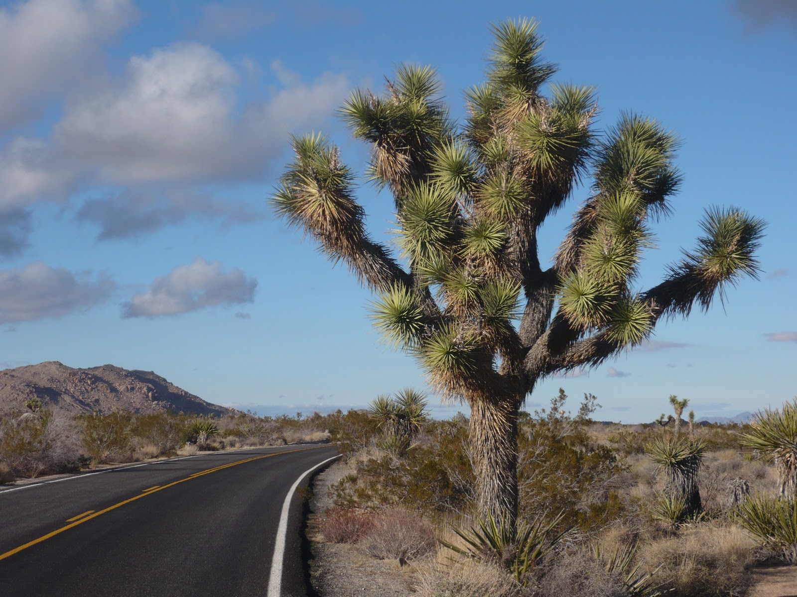
So as we're headed south on US97, I suggested we take one of those "roads least traveled" to get to the Fossil Beds. On my map, it showed a little red line going south, then east across an unshaded section of the grid. To me that signified more-or-less flat, or at least no big mountains. There were some little grey squiggles for a mountain range a little further east, but no passes were shown or even little tiny numbers identifying the elevation of a mountain. How would I know the little red curve on the map disguised a twisty, windy, narrow, steep road downhill???? George wasn't yet comfortable being pushed by the trailer, so he was a tad upset…I'm not sure he even registered the views of the layers of hills off to the side. He doesn't swear, but the atmosphere in the truck was both sizzling and frosty.
Enroute to John Day Fossil Beds
(Digression: Ever wonder why those roads are least traveled? It's because most people are smart enough not to venture onto them for some pretty valid reasons. Few of these roads are marked with warnings to avoid them with a trailer.) 
Palisades
Once we got to the park, we parked and walked up to the picnic area for a rather silent lunch, then loaded up the cameras and hit the trails. There are 3 really short trails right there at the Palisades:

1. Geologic Time Trail from the picnic area to the trailhead with interpretive signs that explain pre-historic events that caused the landscape to look like it does. (I walked this one, while George drove the trailer down to the trailhead area.)

Moving the trailer

2. Trail of the Fossils with lots of huge boulders that fell from the cliffs have fossils in them. The tree trunk was pretty obvious, but I couldn't always see the leaves…

George checking out the fossils

3. Clarno Arch Trail climbed up to the base of the Palisades cliff so you were just below an arch created by erosion. 

Clarno Arch

When we left there, we decided not to attempt the other 2 units this time around. And, even more importantly, we stayed on OR218 to get back to US97 and on to 1000 Trails Sun River at Bend. We had the GPS (we call her Gertie) telling us which way to get to the resort, and it was fine until we got to Bend. She then took us through town around a zillion traffic circles, then out of town to the resort. The road kept going up and up….and up. There was snow at the side of the road. We saw signs to Mt. Bachelor! We're still pulling the trailer. We don't have chains for either truck or trailer! George was getting testy again…so we found a place to turn around and go back to town, back around all those traffic circles and back to US97, with Gertie "recalculating" all the way!
 
Gertie was apparently trying to take us west on the scenic route to the ski resort then south to Sunriver (approx. 40 miles), rather than take us straight down 97 (10 miles), definitely not something we wanted to do at dusk in snow country. There doesn't seem to be a way to program common sense into a GPS unit, so I did the next best thing and put her on mute! 

We only stayed 2 days at that campground. Lots of deer grazing around the trailer, which I thought was pretty cool. We left Bend before an expected snowstorm, and headed south and west to Grants Pass to visit my cousin Charlotte.