October 9, 2017

10/3/17 - Kodachrome Basin SP


Since we'd already taken a little stroll on the Mossy Cave Trail, George wasn't thrilled about going somewhere else today.  I still wanted to go to Kodachrome Basin State Park--and it was only another 15 miles.

Kodachrome Basin was named in 1948 by a National Geographic Society Expedition in honor of the then revolutionary Kodak film that was celebrated for its color accuracy.  Now the cameras (and phones) are all digital and a lot of people only know about Kodachrome from the old Paul Simon song.

In a state with unusual geographical formations, the rocks here are....well....unusual.  There are more than 60 upright cylindrical chimneys called "sand pipes", ranging from 6' to 170' in height.
There are several theories about how these pipes were formed, which basically comes down to "the geologists don't have a clue".  I always want to know stuff like this, but "nobody knows" works for me too.

I couldn't talk George into hiking the 3-mile long Panorama Trail, but he agreed to drive up to the end of the road to see more formations.  Eagle's View Trail starts here, but it's closed. (Since it was closed because of erosion in 2010, I should probably have said "still closed".  Don't know why it's even listed in the park guide, but perhaps someone is optimistic that they will eventually rebuild the part that fell off or it will fix itself.)  
It was easy to talk him into Angel's Palace Trail.  Longer than Eagle's View (1.5 miles instead of .5) but not as steep (150' elevation gain instead of 500'), it's ADA accessible.  I figured George could handle that, even though we were over a mile high.  Sometimes higher elevation makes it hard for him to hike.  Parking is next to the campground.
The trail zig-zags a lot and there are loops.  Sometimes it's a bit hard to follow the different colors of trail markers to know which way to go.  There's one loop that we didn't take because we thought it was a different trail.  Besides the pipes, there are other interesting formations here.
...as well as some great views of Kodachrome Basin.
We got to the end of the trail...sort of.  Neither of was willing to walk all the way out onto this fin.  There's no guard rails and it's nowhere near wide enough for me!  I like the view from here, thank you very much.
After we finished the loop and got back to the truck, we took a little drive through the campground.  It's a really nice one, with spacious sites, and about a third have power.  George said he'd be willing to stay here sometime, even without full hookups.  (Yahoo!!! I'm thinking one year when we go south for the winter, we can go to Moab again, then pick up Hwy. 12 at Torrey.  That'll give us the rest of the Scenic Byway and more country we haven't seen yet. I'll plan in advance and make reservations at the campground.)
A few more pictures of Kodachrome Basin State Park

October 7, 2017

10/3/17 - Mossy Cave Hike

Scenic Byway 12 is Utah's only All-American Road.  I didn't think I could talk George into the whole 129 miles to Torrey, but sometimes you do this sort of thing in bits and pieces.  Escalante sounded good, but I'd settle for Cannonville if he'd agree to Kodachrome State Park.

We passed the junction for Hwy. 63 into Bryce Canyon National Park because I was saving that for another day.  Four miles later, I saw the sign for the Mossy Cave Trail parking area alongside the road.  We stopped to go on the short hike.  George really wasn't getting into the purpose of my route for this trip south--to return to places we'd already been, then explore new things or favorites.  To break him into it gradually, I had to promise it would be a short hike.

When people ask me what my favorite place has been on this whole journey, I always tell them it's the red rocks in Utah.  I don't care if they're sculptured hoodoos, slick, stacked or arched.  The rocks high above this trail fit the criteria.
I kept getting a glimpse of windows in the rocks on the rim.  It was sort of a "now-you-see-it,-now-you-don't" peek, but I kept my eyes open and up.
The trail runs along the Tropic Ditch.  In 1892, Mormon farmers diverted water from the East Fork of the Sevier River over the cliffs of Bryce Canyon into the Tropic Valley for irrigation.
We met another couple along the trail, and continued with them.  Nice people caravaning with friends heading to Arizona for the winter.  The season begins early for some snowbirds.

After the trail crosses the ditch, it forks and goes to either the waterfall or the cave.
We all opted for the waterfall first.  This was not a major decision.  I didn't think it would really matter since I'd planned to see both anyway.  It wouldn't make the short hike much longer. 
Finally got a chance to see the windows I'd seen earlier.  I counted 4, George thinks there are 5.  Pretty sure one of us right.
Next up was the cave.  I knew it wouldn't be Mammoth or Carlsbad, but unless there's more of it below the viewpoint, I'd hardly qualify it as a cave.  (The park calls it a "grotto"--I would have said "overhang".)  Glad we went to the falls first.
When we got back to the truck, we exchanged name cards with Vern and Barbara.  Hope to see them in Arizona this year.

More pictures from Mossy Cave Hike

September 30, 2017

9/27/17 - Antelope Island State Park

(11/10/17 - Still catching up...this is the last place we went in September.)

We'd been through Utah several times but hadn't gone to the Great Salt Lake since our honeymoon.  There's a state park out in the middle of the lake, so we decided to check it out. We drove across the Causeway to Antelope Island State Park.

You have to drive across a 7-mile long causeway to get to Antelope Island, which is the largest island in the lake.
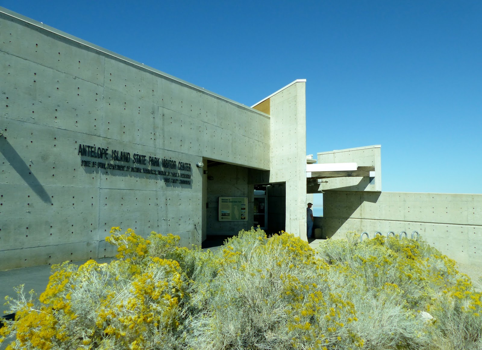
There's a marina on the right just before the end of the causeway but this time of year there was only a single boat tied up to the dock.  We drove past it to the Visitor Center, visited, then headed out to look for buffalo.  (Okay, bison.  I know they're bison.  I grew up saying buffalo, so it slips out sometimes.  I'll try to do better.)
 
After Yellowstone National Park in Wyoming and Custer State Park in South Dakota, the island has the largest free-roaming buffalo bison herds in the US.  Some of them even get painted.
John Charles Fremont mapped the island in 1843, then a few years later named it after dinner.  That is, he named the island for the meat they shot for dinner there.  There are still about 200 pronghorn on the island--look closely and you can see them. (Antelope are officially pronghorn--just pronghorn, not even pronghorn antelope.  I have no idea why Fremont didn't call it Pronghorn Island, but it does sound kind of awkward.)
We'd seen quite a few buffalo bison in the distance as we drove south towards Fielding Garr Ranch.  Then we finally saw some near the road.  I think every buffalo bison I've ever seen is scruffy.  I wonder when they actually finish shedding and grow a new coat.                                   
          
The Fielding Garr Ranch was established in 1848 when widower Fielding Garr and his 9 children were sent by the LDS Church to maintain the tithing herds of cattle and sheep.  The church sold the ranch in 1870  and it was renamed the Island Ranching Company.  It continued as a working ranch until it was sold to the state of Utah in 1981.  It's pretty much as it would have been in 1973--only rustier.
We wandered around looking in the buildings, checking out the machinery, trying to figure out what some of it was used for.  I knew the silo was for storing grain.  George had to tell me the other thing was for stacking hay--the brochure calls it a portable "Jayhawk Stacker".  It's similar to the bigger ones we saw in Montana.  The giant chair is just for fun.
 
The original adobe ranch has has been turned into a museum.
This was a working sheep ranch, so it's no surprise to find a wagon they call a "Sheep Camp".
And, of course, if you have sheep, you have to shear them.  The corrugated metal Shearing Barn was built in the 1920s.  By then the island was one of the largest sheep operations in the western US.  It has an engine used to power the shearing stations.  I had no idea they would have been so automated, but this mechanized equipment let them shear a sheep in minutes instead of half an hour by hand. If you're shearing 10,000 sheep, that would definitely speed things up!
They could hold 1,000 head of cattle in the corrals.  This is the backside of part of the building.  Later they had farrowing pens for pigs, and now old trucks and farm machinery are stored there.
On the way back, we saw more buffalo bison.  This big bull was sticking out his tongue, which seems like an odd thing for a buffalo bison to do.  I'll ponder this some other time.
 

More pictures of Antelope Island


September 28, 2017

9/17/17 - Birds of Prey Center


11/3/17 - Got a little sidetracked when we got to Arizona and saw friends we hadn't seen since last year.  We went here in September.

The World Center for Birds of Prey in Boise, Idaho, is the headquarters for The Peregrine Fund, an international non-profit organization that conserves endangered raptors around the world.  We missed the entrance sign, and were going to stop on the way out, but forgot.

Entrance is in the Gift Shop, then out the back door.  There were a few birds in cages next to the building.  This Bateleur Eagle is from Africa, where he's "Near Threatened".  Don't think I'd even heard of this one before.
There was a Turkey Vulture right next door to him.  We've seen these guys before.  They live in both North and South America, so are pretty common.  There was a volunteer who was talking about how beneficial they are because they eat carrion, which helps prevent disease.  Like many species of wildlife, the use of DDT for insect control in the 50s and 60s killed a lot of them off, but their population status is now considered "Least Concern". (I'm pretty sure that doesn't just mean someone didn't like these rather ugly birds.  The eagle is much prettier, but maybe the vulture's mother found him adorable.)  
Just around the corner is the Condor Cliffs Exhibit.  The California Condors are the original project of the Center.  These condors are the largest bird in North America--and the most endangered one.  Even George's wingspan isn't as wide as a condor's.  
In 1982 there were only 22 left in the world, and every single one of them was placed in captive breeding programs.  This place has more than any other facility.  They breed them here, and release young ones at Vermilion Cliffs National Monument in Arizona, just north of the Grand Canyon.
Again, not a candidate for the Beautiful Raptor Pageant, but just because you're ugly doesn't mean you should have to go extinct.  This year they released 18 California Condors to soar high above the Grand Canyon.  Their status is now officially "Critically Endangered", which is a whole lot better than "Extinct"!
 
If you look closely at the birds above, you'll see numbers on them.  (One is 44 and the other is something else.)  We asked the guy that did the live bird presentation what the numbers were, but he didn't know.  I'm thinking that instead of names, they gave them numbers when they were hatched.  There are now 446 condors flying around in the world.
After checking out the condors, I left George talking to some people and wandered back to the other cages.  This Ornate Hawk-Eagle is from forests in Central and South America, and is "Near Threatened".
The Bald Eagle is the only eagle unique to North America.  He's "Least Concern" too.
We wandered around inside the Velma Morrison Interpretive Center, which has a lot of displays and exhibits about different kinds of raptors. The condor exhibit explained a lot about recovery and had one that obviously didn't make it hanging from the ceiling.  
 
Neither did the Peregrine Falcon below, although the species was removed from the "Endangered" list in 1999.
They have Discovery Room for kids.  These two were having a ball...never did see them learn to fly, but they did run around a lot flapping their wings.
Back behind the exhibits is a Viewing Hall where you can see more live birds.  I kept forgetting about the double-paned windows between me and them, so I'd get too close and clunk my camera--or my nose--on the glass.  The Orange-breasted Falcon is a "Near Threatened" bird from South America.  
The Eurasian Eagle-Owl is a big owl from Europe.  His scientific name is fun--he's a Bubo bubo--has something to do with sounds the male makes.  I'd call him "Bubba".  
The Northern Aplomado Falcon from the American Southwest and Mexico is the only falcon in the United States on the Endangered Species List.  He's a wee-bit scruffy.
At 2:00 we went to the Live Bird Presentation.  One of the docents was doing a show-and-tell on a couple of the birds they have in the program.  
When he was done, he took the whole group across to the other side of the parking lot to the Archives of Falconry & Library building.  There they have a lot of things relating to falconry. They have a lot of material for researchers, including the most comprehensive English-language falconry library in the world.  There is falcon art and displays with equipment the falconers use, like the leather hoods they put on the birds before they send them to hunt.  
One wing was sponsored by the son of His Royal Highness Sheikh Zayed bin Sultan Al Nahyan from the United Arab Emirates, designed to show how Arabian falconry is practiced by nomadic Bedouins today.  There's an exhibit of a Bedouin tent, complete with furniture and rugs.  Home with all the creature comforts, transported on a camel, it looks like the Arabian version of RVing.
In this case, it's not the falcons that are endangered--it's their prey.  The chief quarry of the Arabian falconers is the Houbara Bustard, which is endangered in some locations, but doing well in others.  Sheikh Zayed set up an extensive captive breeding program for them.
I think the Archives are a great idea, and probably more interesting to falconers.  Good plan to save the stuff before it all disappears.

Back outside, I'd hoped there was going to be a demonstration of one of the raptors in flight, but we were a week early for the Fall Flights. Maybe another time when we're in Boise.  

More pictures here:  Birds of Prey Center