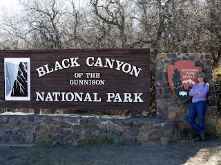
I was looking forward to visiting Black Canyon of the Gunnison National Park—not because I knew what to expect, but because I really didn’t have a clue.
- Canyon? Yep, got that!
- Black? Must be...
- A river runs through it? Probably the Gunnison River.
Apparently a lot of other people know about as much as I do about it. It only had a little over 200,000 visitors in 2015. (For comparison, the Grand Canyon had 5.5 million; Yellowstone had over 4 million; even Death Valley had over a million!)
Tomichi Point is the first viewpoint after you head into
the park. Suddenly I understood what
this place was all about! Not only is it
a big black canyon with a river at the bottom, it’s different than any other
canyon I’ve ever seen. The cliff walls
are jagged and sheer; the gorge is deep and narrow; and even in the sunshine,
it’s dark in color and emotion.
At the South Rim Visitor Center, I learned that the rocks
of the canyon are metamorphic gneiss (pronounced “nice”) and schist (pronounced
like there’s no “c”; make sure you get the second "s" in the right place.) I suppose I learned this stuff at some
point in my life, but now I’m just going for the way they sound. I realize that this is a novel approach to
geology, but it works for me. Obviously I like the nice rocks best.
Before dams, the river slammed through at flood stage at
12,000 cubic feet per second with 2.75-million-horsepower force!!! My mind can’t really comprehend this. Even now, the river is classified as Class V
to Unnavigable for kayakers.. (I’d tend to go with unnavigable and forget
the whole thing.)
We stopped at (most) of the viewpoints, although some of them were a bit of a trek to get to the rim where the view was. Some of the overlook signs even showed yardage. George still wasn’t feeling quite up to par (I know this because he’s not interested in golf yet) so at a few of the stops, I took a walk with both cameras.
First stop was Gunnison Point, where there were stairs
leading to a section of lighter colored rock called a pegmatite dike, a softer
rock that’s .... The white band... across the canyon used to be connected to
the overlook one. Squint and you can see
the river below. Listen and you can hear
it.
At Pulpit Point there are picnic tables...and a
viewpoint. It’s 134 yards to the
overlook out on another chunk of rock handily available for tourists. It’s easier to see the river from here.
There’s no information sign at Cross Fissures View (357
yards), so I can only hazard a guess about the fissures. But the canyon wall on the north
rim does look different.
Rock Point (254 yards) is out on another pegmatite
dike. These rock islands should make me
feel a little queasy, but they don’t.
Even looking down doesn’t seem to bother me.
Devils Lookout isn’t much farther down the road, but it’s
a little farther down the trail (607 yards).
Once again, no program, no sign, so I don’t know why the devil got
involved. I do know it’s a long way
down.
Chasm View is near the road—or perhaps the road is near
Chasm View—and the river is easy to see.
This is where the cliffs are steepest.
These signs are at the start of each trail to the rim.
Painted Wall isn’t quite so close, but not so far
either—it’s 200 yards that-a-way. The
sign says that at 2,300’, it’s the highest cliff in Colorado. The lighter lines on the cliff were created
when molten rock squeezed into fractures in the existing rock. (I’m not sure I ever knew that could happen,
so I guess I don’t have to feel bad about forgetting it.)
We skipped Cedar Point and drove on to Dragon Point, which is just a short 100 yards.
George stayed in the truck again so I was chief photographer. I thought there was more painted wall at this
viewpoint than at the one with the official name. This is some wicked canyon!
At 8,289’, High Point is the highest point (ha!) in the park, but
the trail to Warner Point on the rim is a mile and a half. George wasn’t interested in going, and I didn’t
want to make him stay in the truck that long.
By the time we made it back to the road to East Portal, it was getting too late to drive down to the river. Hairpin curves on a 16% grade to the river--no vehicles greater than 22' allowed. Since the water access is at the bottom of the cnayon, it wasn't in the sun anyway, so I let George convince me it was too dark. I wish we'd gone...looking up from the bottom would have been really cool.
Click for more pictures: Black Canyon of the Gunnison Natl Park


Post a comment.
Post a Comment
Please leave comments here: