April 18, 2012

4/16/12 - Zion NP

This was actually my 3rd time to Zion National Park.  First time I was 12.  The 2nd time was when George & I were on our honeymoon.   Now it's 22 years later.  The rocks haven't changed a lot, but the park and I certainly have.  For one thing, you can forget about driving in the park.  From April-October, Zion Canyon Scenic Drive is open to shuttle buses only. 

There are 9 shuttle stops.  We stopped at most of them to take pictures and go on a few trails.
At the Temple of Sinawava, we took a 2-mile stroll along  the Riverside Walk.  At the far end of Zion Canyon, it follows the Virgin River through the Zion Canyon to the Narrows.  The Narrows are closed now because of the possibility of flash floods, but I wouldn't be interested anyway.  (Are you kidding?  Me?  Wade in the river where the water is ice-water cold*, the current is fast and the rocks are slippery?  No-thank-you-very-much! )


Next trail was the short but steep Weeping Rock Trail.  It ends at a rock alcove with dripping springs  and a pretty view.
The last hike we took was from Zion Lodge on the Lower Emerald Pool Trail.  We'd done this one when we were there in June, 1990.  The waterfalls didn't look nearly as inviting as when the temps were baking over 100! 


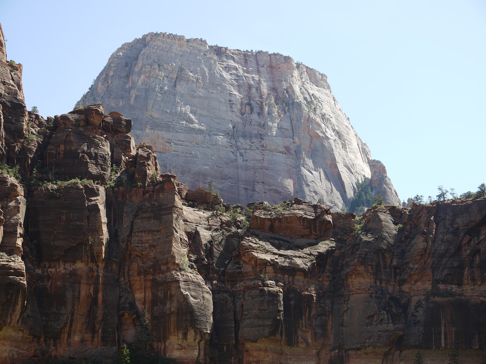
All these trails were paved, and there were lots of people, even in April.  We saw most of the major peaks of Zion (except for Checkerboard Mesa which is near the East Entrance), but I have trouble remembering which is which--except for The Great White Throne, of course. 
*How do I know the temperature of the water? I stuck my fingers in the river. Then I poured some water from George's water bottle (which has ice in it) on my hand. Ergo, the river water is ice-cold!

More pictures here:  Zion NP 


April 15, 2012

4/9/12 - Pipe Springs NM

Driving across the Arizona Strip to our next RV park, we drove right by Pipe Spring National Monument.  I'd called the Visitor Center weeks before to ask if there was parking available for big trailers.  I was assured it was no problem.  I reassured George several times that we'd be able to park the RV!

An oasis in the desert near the Vermilion Cliffs, the monument is part of the National Park Service.  I was a little confused by the sign to the the Visitor Center--it's an unexpected joint effort between the NPS and the Kaibab Bank of Paiute Indians. 

The Paiutes lived in the area for hundreds of years.  These are examples of their dwellings, or kahns.
The museum has some cool Paiute artwork.
In 1871 Mormon pioneers built a ranch/fort, called Winsor Castle, over the springs.  We went on the tour to see how the settlers lived.
 
Look closely at this settee to see how it opens out to form the original Hide-a-bed!

Outside are replicas of stuff you'd find on an old ranch. I liked the Longhorn cattle. 


Check out the link for more pictures:  Pipe Springs NM

April 14, 2012

4/8/12 – Wahweap & Horseshoe Bend

The weather had been lousy for the last few days--lots of wind and even some rain--so there were a couple of "must see" places for the last day in Page. 

First we headed north back across the Glen Canyon Dam to Wahweap on Lake Powell.  If you squint, you can see the bridge across the canyon and the dam. 

Wahweap Marina is in the other direction.  It looks like a city of the biggest house boats you'll ever see!!!  And they're definitely NOT in our budget!


Next stop was back across the dam to the Horseshoe Bend outlook south of Page.  When you get to the parking lot, you'd never guess there was a river nearby--all you can see is a trail of people heading off across the desert!
It’s a ½ mile hike out to the canyon which lets you get lots of sand in your shoes.  At the start of the trail, there’s a cautionary sign that tells you there are no guardrails and the rocks aren’t stable.   (I could already tell that acrophobia might become an issue.) 

There were lots of wildflowers along the way.  In order:  Canagre Dock, Scorpionweed, Desert Dandelion.  And, no, I didn't know what they were when I took their little pictures.  Well, I did say that the yellow one looked like a dandelion--I was a bit surprised when I found out that it was!
Acrophobia--which I prefer to define as "extreme caution in high places"--works a lot like guardrails, except there’s nothing to hold on to.  I sat down, then crawled a little closer, but not as close as the woman in the 2nd picture.   It’s a long, long way down! 

George was a lot braver than I was.
AND he got better pictures!
Click on the link for more pictures of Wahweap:  Wahweap
Then click on this link for more pics of Horseshoe Bend:  Horseshoe Bend