April 22, 2015

4/18/15 - The High Road to Taos (and down)

The High Road to Taos Scenic Byway usually starts in Santa Fe, but we were staying at an RV park in Pojoaque, about 15 miles north.  First stop was the historic Nambe Trading Post.  Over 75 years old, apparently it went out of business, but was recently restored by Cathy A. Smith, Emmy award winning authentic costume designer in films like Dances With Wolves.  Not much to look at outside, inside the collection is a work of art all by itself.  Some of it's antiques, some made by contemporary artists, some just higher quality souvenirs. This is one of the few times I wish I had more space in the RV.

We followed NM 520 to NM 76, winding through tiny towns that seem to have little going for them except scenery.  But the scenery is pretty amazing.
This is the little town of Truchas.
The mountains in the background are the called the Truchas Peaks.  Obviously the mountains have been around longer than the town, so I assume they named the town after the mountains and not the other way around.  Among the highest in the New Mexico Rockies, they rise over 13,000'.
The road begins climbing...and climbing...and climbing.  We began seeing more trees, taller trees.
This cool old flume beside the road still has water running down it.
There's a cemetery alongside the road in Chamisol that caught my eye.
At the junction of NM 76 and NM 75, we turned east on 75 for a short way until we got to NM 518 and we turned north.  (Sounds awful, doesn't it?  We only got lost when I had George turn off into the little towns and missed the signs labeled "High Road to Taos".)  Someplace along there the altimeter on the GPS showed we were over 8,000'.  I think there would have been pretty views of the mountains and the forest, but the clouds were getting dark and ominous.
By the time we got to Taos, little tiny snowflakes were falling, although they didn't last.  We stopped at the Taos Plaza, which has been there over 300 years. There were lots of cars parked around it, but Taos doesn't seem to have opened for tourist season yet--though I shouldn't whine because it did save George some money. The only shops that were open were the cheap junky ones and the really expensive galleries.  And a coffee shop--where the barista didn't even know what I meant by "double tall latte extra hot".  (Sometimes it's rough being from Seattle...)  I think there will be people here in June!
We still couldn't tell what the weather was going to do, so we cut out the Taos Pueblo visit. (There will be another chance, George!) I planned on heading back home* on the lower River Road but first we made a detour--NM 64 E to the Rio Grande Gorge.  Doesn't look like much when you get there...at least until you look down.
We parked and walked out on the bridge.  Next to the overlooks are a sad reminder that not everyone goes there for the view.
 
There's a rest area on the far side where we stopped to get a view of the bridge itself. Good thing that's all we needed to do--the restrooms were all locked up tight. I told you it's not tourist season yet!
Back in the truck and turned towards Taos, it started to rain.
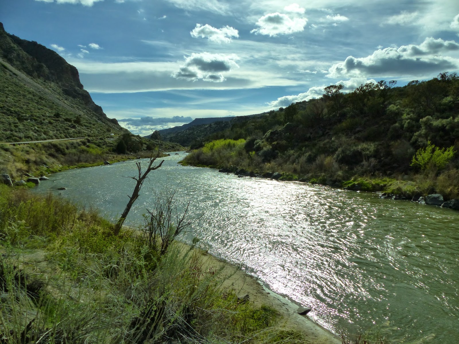
It didn't last long (I'm beginning to think that's typical of New Mexico), so by the time we got down to the river, it was nice again.
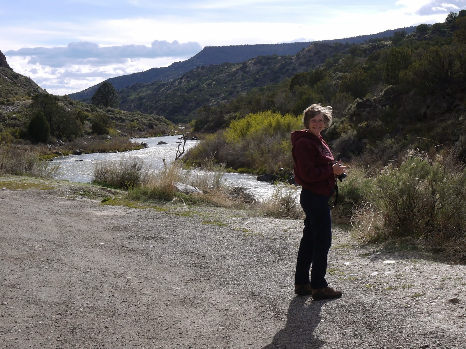
When I think of the Rio Grande, I think Texas because the whole southern border of Texas is the Rio Grande river. Well, it has to come from someplace--it starts in southern Colorado and flows all the way through New Mexico to the border of, ummm, Texas and Mexico. (Go look at a map; you'll see what I mean.) It parallels the road here.

This is an old footbridge that I wouldn't consider crossing! It's in really bad shape now, but I wouldn't consider crossing it when it was new.
As we got away from the river, the dark mountain shadows were silhouetted against the clouds.
I like sunshine best, but this is pretty nice too.

* Surprised that I'd call an RV "home"?   It's what we've lived in for 4 1/2 years. I don't know what else I'd call it.  There are bumper stickers that say "Home is where you park it". 

For a few more pictures, click the link:  High Road to Taos

April 19, 2015

4/16/15 - Bradbury Science Museum at LANL

Ever heard of the Bradbury Science Museum? How about the Los Alamos National Laboratory? How about the Manhattan Project?

LANL (as it's abbreviated all over the town of Los Alamos, New Mexico) was a top-secret research lab established in 1943 as part of the Manhattan Project to develop the atomic bomb. They're till researching, now under the Department of Energy. Still secret I suppose.

We watched the video "The Town That Never Was" about the Manhattan Project and Los Alamos from 1942-1945.  It really was TOP SECRET! People that worked and lived at Los Alamos all had the same Santa Fe PO Box (1663), traveled using aliases, had their outgoing mail censored, had driver's licenses with numbers instead of names.

There are three galleries.  History is (obviously) focused on the Manhattan Project. There's a timeline, and a lot of displays that try to cram everything in together.
This is a model of the "Gadget", the first plutonium bomb. It was detonated at the Trinity, NM, test site in July, 1945.
One whole wall and a little extra has photographs and stories of the people who worked at Los Alamos during the war. That was pretty interesting, but I didn't read them all.
The next gallery is Research, with hands-on activities as well as zillions of current projects that the National Lab might be working on.  There's a small display on nanotechnology that was a little bit interesting, but we didn't spend enough time for me to get much out of it. There are lots of videos if you want to watch them..
George liked the interactive exhibits. I think this was about how much electricity is in your body. He has more than I do (except possibly on a really bad-hair day).
I wandered around (literally) a display about historical computers.  The ones the Manhattan Project used were pretty sophisticated calculators. They have a setup where you can learn how to use it, then try it yourself. Harder than it looks.
There were displays on the vacuum tube computers of the 1940s and 50s, and on the transitor computers of the 1960s, with a bit of history on the men who developed them. 

The Defense Gallery included models of both nuclear bombs used against Japan in WWII.
"Little Boy" was the uranium bomb dropped on Hiroshima in 1945.


"Fat Man" was fueled by plutonium, and dropped on Nagasaki three days later. (I'm not going into the pros and cons of nuclear weapons. It's part of our country's history; deal with it.)

I assume the idea of a museum was a PR plan to show positive aspects of nuclear energy rather than the US just blowing up the world. It's a lot of information stuffed into a rather small space, so it was a bit overwhelming and unproductive.

NEWS ALERT:  The NPS is going to create Manhattan Project National Historical Park, consisting of three units: Oak Ridge, TN, Hanford, WA and Los Alamos, NM. Should be interesting to see what they come up with. I recommend checking out the museum at Pecos NHP.  (Few words, big print, lots of pictures--sort of like a little kid's book.)

More pictures of the Bradbury Museum and a few LANL buildings we saw in town:  Los Alamos Natl Lab   What do you suppose that thing in the last photo is???  

April 17, 2015

4/15/15 - Bandelier NM

Before you get your expectations up about this being a battlefield, let's get this out of the way right now. A bandolier is "a shoulder-belt with loops or pockets for cartridges".  Bandelier National Monument is named after anthropologist Adolph Bandelier, whose work established the foundation for much of modern southwestern archeology.


So the park is about the ancestral pueblo people who lived here until about 500 years ago.  Don't cliffs like this just make you want to build a house here?  (Assume there's a History Alert. We're talking about pueblos and cliff houses here.)
In the Visitor Center, we watched the video and checked out the exhibit room--which is nowhere as good as the museum at Pecos NM. Then we headed outside to the Main Loop Trail on the way to the cliff dwellings.
Along the way was Frijoles Creek. (In Spanish, that's "little river of beans"--which cracked George up! See? He does have a sense of humor!)  Looks pretty benign here, but in September, 2013, they had the largest flood in park history. More on that later.
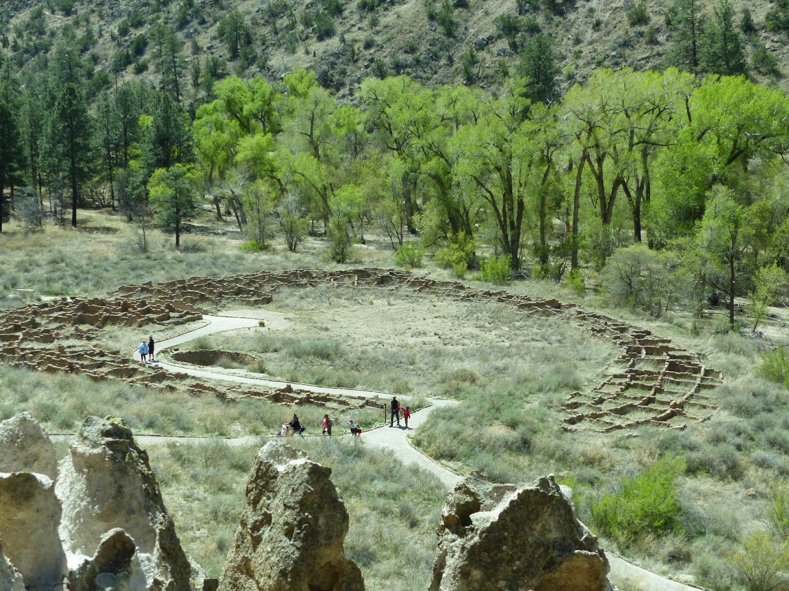
The Big Kiva is quite a bit larger than the one we saw at Pecos NM.  You can see where some of the wooden pillars that supported the roof were.  The kiva was the community's center.  I think the rectangular openings along the wall might be for ventilation--kivas would be pretty smokey.  Even the experts don't know what the rectangular holes in the floor were for.  (If you know, please correspond directly with the National Park Service.)
The trail goes right through the village of Tyuonyi.  Apparently not everyone liked the high life. The houses were one or two stories high, with about 400 rooms for 100 people.  They had three kivas. When we get higher, there will be more pictures of the village to give a better perspective. 
As the trail circled towards the cliffs, it started to look interesting.  The cliff is made of volcanic tuff, which contrary to it's name is very soft stuff.  Ideal for do-it-yourself-cave-makers.
We'd already been told we could go into any dwelling that had a ladder. But first, there are stairs to be climbed.
 
These cave rooms, called cavates by an early archeologist, were dug out of the cliff wall with stone tools. More labor intensive than the homes in the village below, they probably cost more. Inside the lower walls were plastered and painted, and the upper ones were smoke-blackened to keep the volcanic tuff from crumbling.
Talus House was reconstructed for the tourists with no imagination. As you walk the trail in front of the cliff, there are a lot rocks laid in rectangles, so you can often see where they were.
Here's another ladder--that means I get to climb it and go into the cavate.  It's a little bigger inside than the last one.
                      
From up here you can get a good view of Tyuonyi village.
So then there are more steps to more ladders to Cave Kiva.  This cavate has been reconstructed for us. It's big enough for George to stand up in for a change.  The beams near the ceiling were for loom supports, and the little holes in the floor were for anchors to keep the weaving straight. The graffiti is modern and rude. They have to replaster and smoke the kiva on a regular basis to get rid of it.
 
 
Of course there were more steps--I'm telling you, touring national parks is not for the faint of heart! Some of the trails and steps were built by the CCC.
Now the trail goes right next to the cliff wall.  This series of dwellings is called the "Long House".  Here you can see where the outside house foundations are.  The parallel holes in the cliff wall were for roof supports.  You can see this one had two or three stories.
Question:  Did this big chunk of rock fall before or after the houses were built?  George thinks it was there a long time before they built the house.  I think it crashed down on it. Either way, it sure makes you think.
Count the rows of holes for number of stories.  Sometimes people would stand on the top roof and carve petroglyphs into the cliff wall. (They're very hard to see, even life size and in person.)
After leaving the cliff where the Long House was, the trail crossed the creek.  There you had the option of going back to the parking lot or turning right to go to the Alcove House. We turned right, heading to the base of that cliff way over there.  Then we'll climb a series of four ladders.
George is at the top of the first ladder.  You can just barely see the next 3 ladders.
Below, George is waiting for someone to come down Ladder 2 before he can go up. Then you can see what it looks like from the top!
       

Once you get to the top, you can see the kiva in Alcove House, the size of the alcove, and the roof pole holes by the cavates.

Then it's time to come back down.  FYI, the ladders are bolted for us way better than the Indians' ladders were.  Can't you just see the little pueblo kids scrambling up and down them?  I hung on really tightly.
Oh, yeah--I forgot the caution sign by the first ladder. But now we've been there, done that!
I probably put in too many pictures for this blog posting, but it was kind of fun.  If you're really a glutton for punishment, there are more pictures here:  Banderlier NM