
I wanted to go back to
the National Historic Oregon Trail Interpretive Center (again).
George wasn't enthused, but he tends to think that once we've been somewhere we
don't need to go back. I enthuse easily and tend to think we should go
back and see or do different things at a place we’re already familiar with.
We were here 3 years ago, also in September. (9/5/14 - Oregon Trail Interpretive Center) If you check out the original post, you might find
that the pictures then and the pictures now are very similar. That’s probably a little bit me and a little bit
subject matter. You can skip this if you want...


This year marks the 25th anniversary of the Center. It’s a joint project with the Bureau of Land Management and Trail
Tenders, a local group formed in 1989 as a partner with BLM in operating the National Historic Oregon Trail Interpretive Center.
 To
get to the exhibits, you walk between the live-size wagon train diorama. It takes little imagination to see how hot
and tired mother and daughter would have been.
It would have taken the emigrants several months to get to this point on the trail from
Missouri. The ground here is dry and rocky. They
still have to cross the Blue Mountains before the snow starts.
To
get to the exhibits, you walk between the live-size wagon train diorama. It takes little imagination to see how hot
and tired mother and daughter would have been.
It would have taken the emigrants several months to get to this point on the trail from
Missouri. The ground here is dry and rocky. They
still have to cross the Blue Mountains before the snow starts.George and I get tired driving a couple hundred miles at 60 mph, pulling our 21st century covered wagon behind us. These emigrants walked beside their wagons. A good day was 10-15 miles. Total distance was about 2,200 miles!
The oxen plodded on and on and on. Wheels broke off wagons. People died.


One thing that we hadn’t seen before was an exhibit called
“Finding Fremont: Pathfinder of the West”.
The focus is on John C. Fremont’s mapping expedition through central
Oregon in 1844-45. The junior high
school I went to was named after him, so at least I knew the name from Nevada
history.

I really tried to get George to walk down to the trail
ruts. He really didn’t want to. He knew we didn’t have to because we’d driven
down there last time we were here. We compromised
with a walk down to the Stamp Mill.
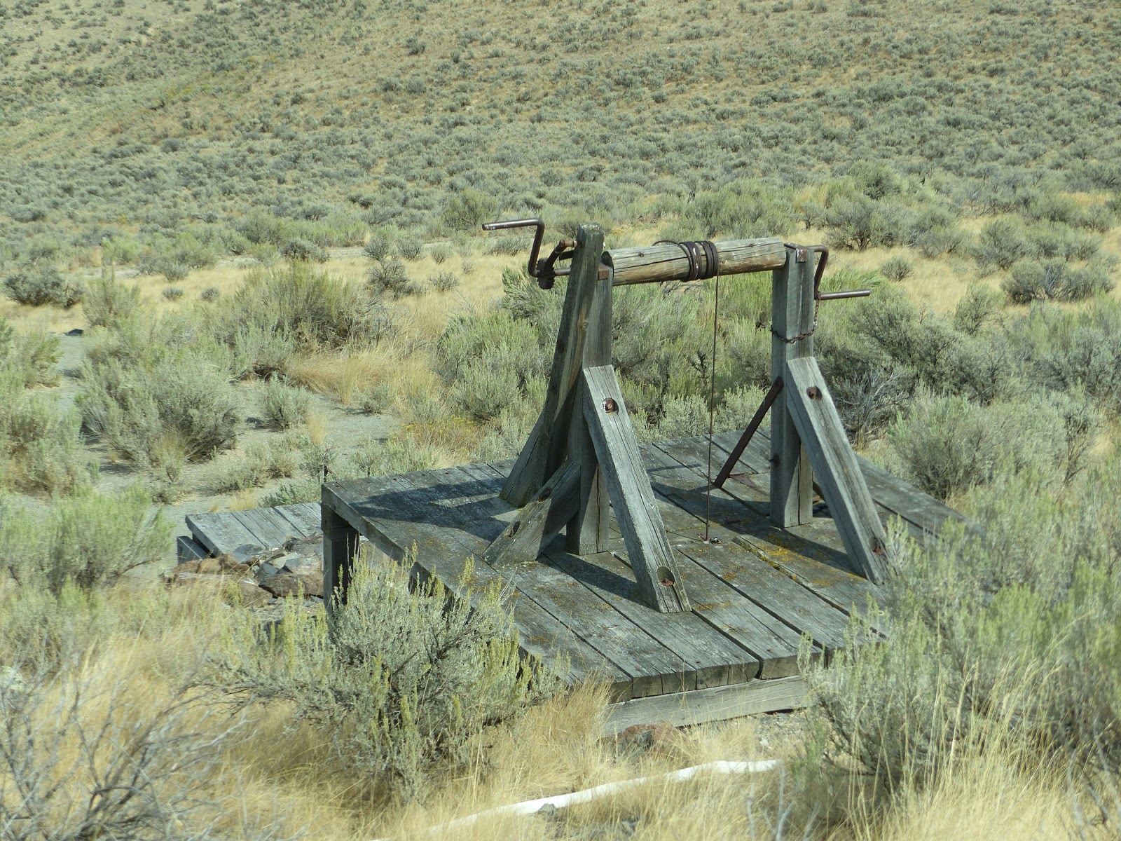
Looks like there’s still a mining operation of some
sort on the hill across from us. They
call it “Cliff Mine” on the information map.

Just downhill from the visitors center are the
remains of the “Hard Rock Lode Mine”.
We continued down the paved walkway of the Panorama
Point Trail to the “Stamp Mill”. George
knew what that meant, but I didn’t have a clue.
Cool building though.

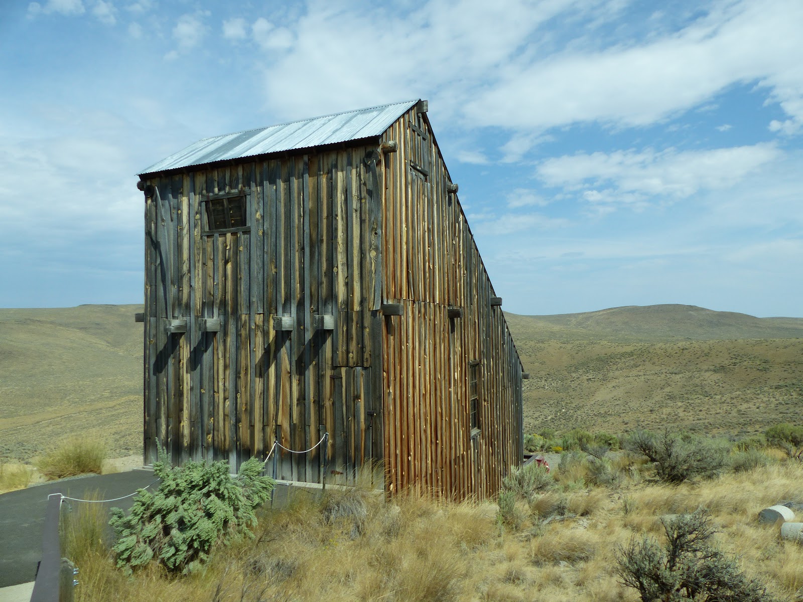
There were information signs inside that explained
about gold mining and the stamp mill. George filled in the rest. One of the best things about this trip is the continuing education we’re
getting about all sorts of things we didn’t know we didn’t know. (Well, one of us at least.)


I wanted to walk out to Panorama Point or the
tracks. We walked a bit longer but not
all the way to either, then got back in the truck to see the ruts again.


More pictures here: Oregon Trail Center (Revisited)
Post a comment.
Post a Comment
Please leave comments here: