
We went to
Chiricahua National Monument in
February of 2011, the first year we were on the road. I liked it, and I wanted to go on a hike, so
I added it to the itinerary for this year.
After the standard stop at the Visitor Center and the
movie and the passport stamps, we headed up the road to the sky island, described as an
isolated mountain range that’s surrounded by a grassland “sea”. The grassland looked an awful lot like desert to me...
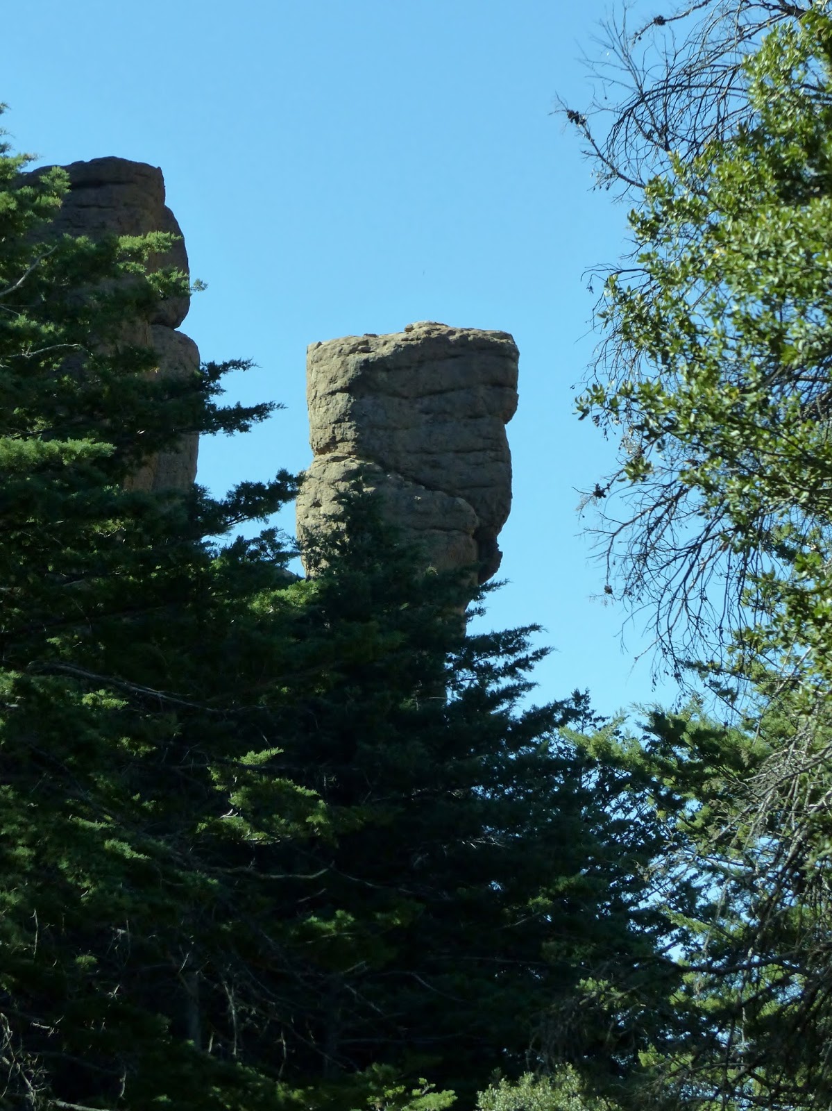
The pinnacles the Chiricahua Apache called “standing up
rocks”
(I love that name!) are the results of volcanic ash that melted together
forming rhyolite. It cracked and broke
over the eons and left spires, balanced rocks and weird shapes. Some have names—like this one they call
China Boy. I have no idea where you have to stand to see that in this shape.

Cochise and Geronimo were Chiricahua Apache—hiding out in these canyons, melting between and behind the rocks, drove the soldiers nuts. Think about that as you look at these rocks. I do.
We couldn’t find a parking place at Echo Canyon, so we
detoured to the Sugarloaf picnic area for lunch. There’s a good view of the wilderness that’s
classified as “Class I, pristine wilderness”.
No franchises out here!

We were joined at lunch with a pretty little Mexican Jay,
but when we ate our own sandwiches and didn't share, he didn’t stay very long. Definitely not long enough for me to take a picture of his good side.
After lunch, we went back to Echo Canyon and easily found
a place to park the truck. We’d barely
started when I began noticing balanced rocks.
This one looks like a bird, with a lizard friend in the background.
Balanced rocks come in all sorts of shapes and
sizes. Sometimes I wonder how some of
them got there. I imagine this whole
place as a playground for the gods...tossing rocks on top of pinnacles, getting
points if they stay balanced, extra points if they’re bigger than the one
they’re on
. (Pretty sure it’s my overactive imagination
again, but this is a great place for it to be exercised.)
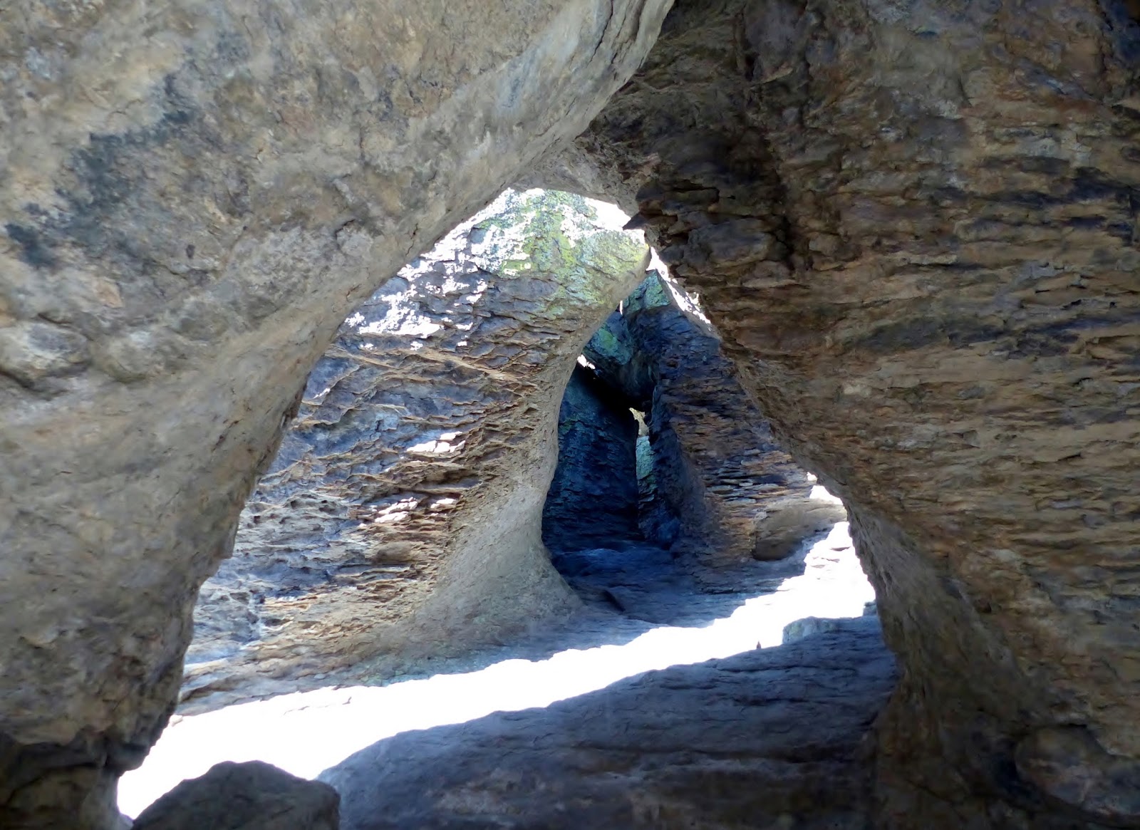
The Echo Canyon Trail takes us through a section they
call the Grottoes. There are lots of
slits and slots and windows created by rocks that are very close together. Sometimes big boulders are lodged between.
I think these look like giant cairns.
There’s a rock wedged in here. I thought it looked easy enough to climb up...so
I did. George didn’t.
After we got to the bottom, we got a different
perspective on the pinnacles.
There are a variety of plants growing in this
canyon. Although most of the flowers are
long gone, some of the seed pods are interesting. The purple one still has blossoms, maturing
into some sort of berries. As I was
taking pictures, a group of energetic hikers passed me going the other way and
someone said something about the plants.
They waited with me until the biologist in their group caught up. I asked him what it was. He hummed and hawed and looked like he was
concentrating on whether he’d turned off the lights at home, then told me he
couldn’t remember.
(sigh) That’s the problem with asking old guys
questions like that; they may have known once but the filing system has gone
awry.


After a mile and a half on the Echo Canyon Trail, we
turned off it and followed the Hailstone Trail for not quite a mile to the Ed Riggs
Trail, which took us back to the truck.
That made the hike 3.2 miles with an elevation gain of 450’. Piece of cake.
We were definitely on the shady side of the canyon as we
walked the Hailstone Trail.
It was a little late but after we got back in the truck,
we turned right to check out the view at Masai Point.
On the way out of the park, several coatimundi ran in
front of us, heading for underbrush on the left side of the road. George had already put his camera away so he
grabbed mine. I know you can’t make them
out, but this is proof that we saw them. Sort of.
 We went to Chiricahua National Monument in
February of 2011, the first year we were on the road. I liked it, and I wanted to go on a hike, so
I added it to the itinerary for this year.
We went to Chiricahua National Monument in
February of 2011, the first year we were on the road. I liked it, and I wanted to go on a hike, so
I added it to the itinerary for this year. 

 We were joined at lunch with a pretty little Mexican Jay,
but when we ate our own sandwiches and didn't share, he didn’t stay very long. Definitely not long enough for me to take a picture of his good side.
We were joined at lunch with a pretty little Mexican Jay,
but when we ate our own sandwiches and didn't share, he didn’t stay very long. Definitely not long enough for me to take a picture of his good side.


Post a comment.
Post a Comment
Please leave comments here: