April 12, 2012

4/7/12 – Cathedral Wash Trail

We'd taken a leisurely walk at Lee's Canyon but I wanted something a little more interesting. The ranger told us the Cathedral Canyon trail was considered a Class 3 hike.  That means there's a moderate scramble across rocks and some climbing, but you don't need ropes.  I wouldn't know what to do with a rope if I found one anyway.  (George heard "moderate". )


The old trailhead was pretty crumbly, so we walked down the road to find a better place to go down. The wash starts off sandy and wide, but quickly narrows.  The cliff walls are layers of Navajo sandstone and other rocks.
Sometimes you have to climb up on the rock wall to continue. 
Sometimes it's really narrow, and there are water tanks you have to go around. 
Sometimes you walk back down in the wash.
Sometimes you go under great big rocks or overhanging ledges.  (This part was easier for me than for the big tall guy.)
At one point, we were walking along a ledge on the wall, and it got pretty scary.  We couldn't figure out which way to go.  There was another couple in front of us, and I figured if they could do it, we could too.  The fact that they were 30 years younger was irrelevant.  (George would have been perfectly willing to turn back then, but I just kept going on.  Isn't it wonderful that he followed me?  After all, he had the truck keys...)


There's one place where there's a 30' drop for a waterfall, which was thankfully dry this time of year.  You have to go down, then around.  (Oh, did I mention I'm afraid of heights?)
At the end of the trail is the Colorado River. 

Of course, eventually we had to turn around and go back up the canyon.  I'd built a few little cairns so we could tell where to go up and down, and most of the time we found them.  Remember the 30' waterfall?  Once we'd climbed back up, we got the water bottles out of the pack.  I dropped the lid to mine...and it bounced all the way to the bottom!  (Of course I had to climb back down to get it--it was the Panasonic bottle I got when I retired--besides people, one of the few positive momentos I got from there!)
Now George knows the difference between a walk and a hike.  And since we handled this one successfully, I should be able to talk him into more hikes.  See you on the trail!

Altho I've probably included most of the good pictures here, you can see larger pictures of Cathedral Canyon by following this link and running the slideshow:  Cathedral Canyon hike 


April 10, 2012

4/7/12 – Lee’s Ferry

It's not easy to cross the Colorado River.  The canyon through Arizona and Utah is deep and dangerous.   
Lees Ferry was built in 1873, and replaced in 1929 by the Navajo Bridge.  In 1995, the original bridge was replaced.  The new one is longer, higher (only 3 feet, but a statistic is a statistic), wider (we don't drive Model-T's anymore!) and (surprise, surprise!) cost a whole lot more!  Can you identify the modern marvel?
After you cross the Navajo Bridge, you drive past the Vermillion Cliffs and the balanced rocks. 
Lees Ferry is at the start of the Grand Canyon, 85 miles upstream from the North Rim.  There's no ferry there anymore, but they still launch rafts for trips down the canyon.  A couple of big ones were taking off when we got there.  
 Then I met some people who were heading off on a 21-day raft trip--way smaller rafts! 
We took a little walk down to the Lees Ferry historic district.  Part of the fort is still standing, and there's some junk for an old gold mine.


There's a trail that goes along the river, but I told George that I wanted to go on a hike, not a trail.  He asked, "What's the difference?"  I smiled at him, took one final picture downriver to the beginning of the canyon and headed for the truck.  (Check out the blog entry for Cathedral Canyon if you'd like to see for yourself.)  
More pictures of the Lees Ferry area:  Lees Ferry

April 9, 2012

4/3/12 – Toadstools Trail

We drove to a BLM Visitor Center at Big Water, UT, in Grand Staircase-Escalante Natl Monument.  (Yeah, I'd never heard of it either!  It's even more confusing when they abbreviate it to GSENM.)  You can't tell from this picture but the building is shaped like an ammonite fossil.  Lots of dinosaur fossils have been found nearby.  I suppose it easier to build something that looks like a spiral shell than a T-Rex.

The Toadstools Trail heads out through a sandy wash along the Paria (rhymes with Maria) Rimrocks to the Toadstools and Hoodoos.
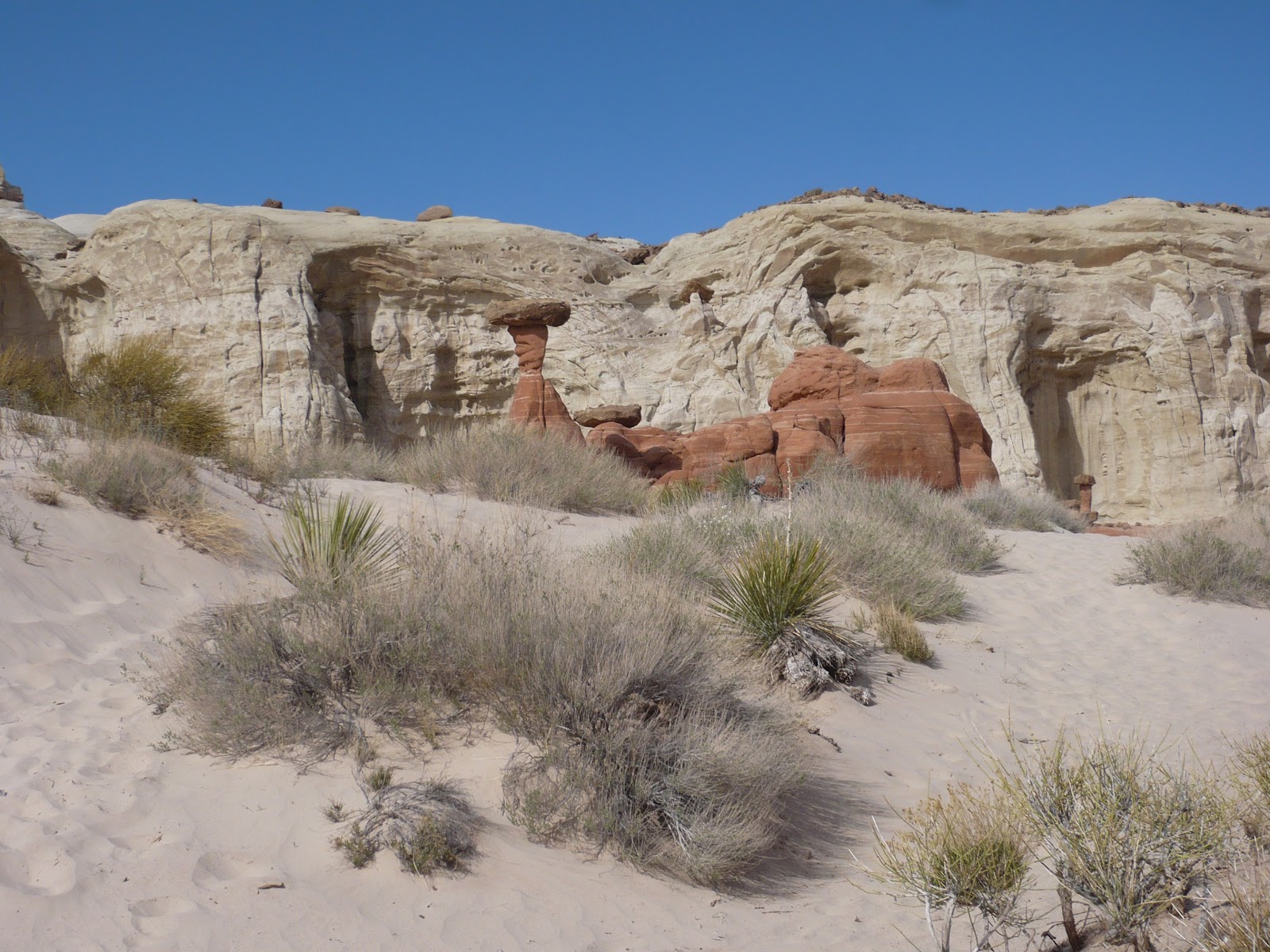
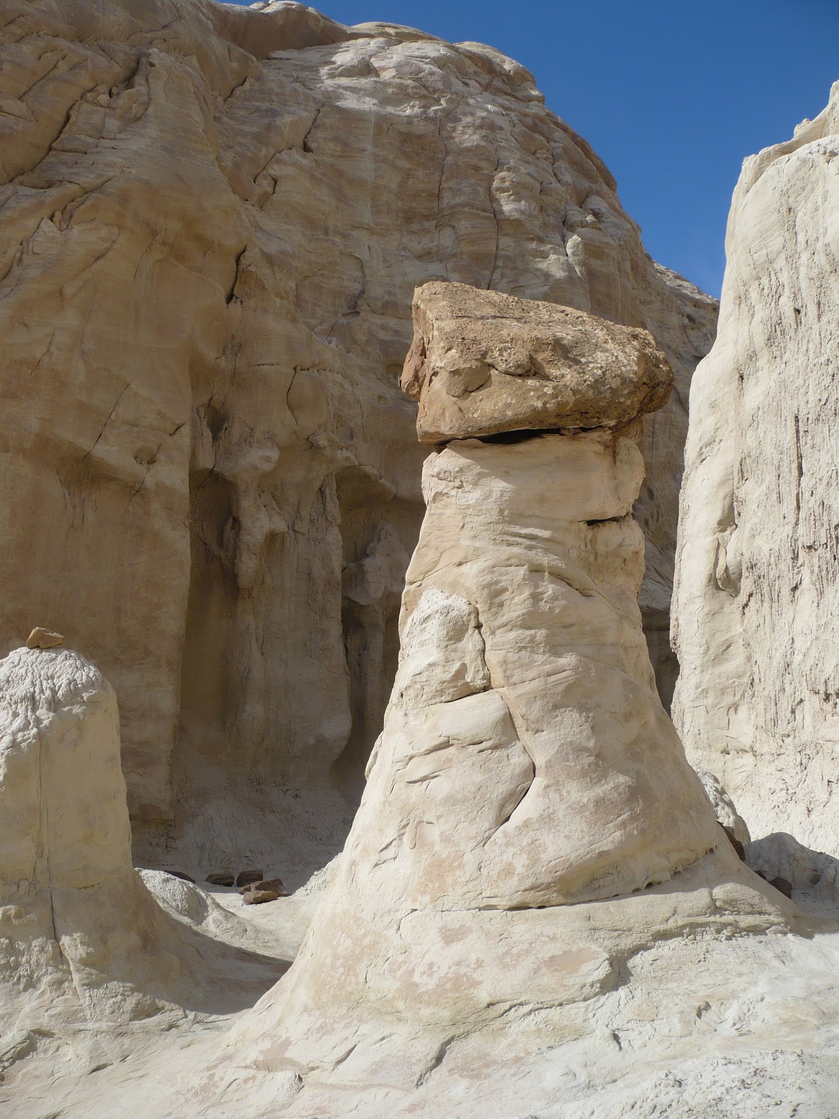
Toadstools look like big rock formations with another rock balanced on top. They're formed when the different layers of rock erode at different times because the bottom later is softer rock. They come in red and white, most with black caps on top, which make them look like giant mushrooms. Since they’re non-edible, they call them toadstools. Hoodoos don't have capstones.  
 There's a bit through the badlands that's kind of interesting. 
Then you see the hoodoo garden up on the hill. 
You have to hunt to find the second trail past the red toadstools to the white ones.  It's a bit of a scramble but well worth the hike.

 Link to lots more pictures of toadstools:  Toadstool Trail