April 23, 2016

4/7/16 - Zion NP (Revisted)

Zion National Park again?  (Zion National Park 2012)  There are just some parks that beg you to return.  (And a few that you wouldn't even if they did!) We were in southwest Utah for a week, so I gave George a choice of going to Zion again or going to Snow Canyon State Park. He opted for Zion.

Good grief!!  Barely April and already there's a traffic jam at the gate.

There are two shuttle routes:  one from Springdale into the park, and another on the Zion Canyon Loop.  We rode the park shuttle to the end, took some pictures, then rode another one back to the stop at The Grotto to start our hike.
We'd hiked to Emerald Falls before, but had never gone beyond the lower pool.  We decided to take the Kayenta Trail up to the upper pools, then loop back down another trail back to Zion Lodge. After crossing the Virgin River and taking the requisite pictures of Angel's Landing, we turned left onto the trail.
The view is always dramatic and impressive in Zion, although this day the sky wasn't always as cooperative as I'd like.  As long as I'm looking up anyway, I want perfect blue sky as background. 
Total elevation gain is only about 350', even to get to the Upper Pools.  The round trip loop is about 3 miles, so that's not bad--even for old people like us.  There was a steady stream of people heading up and back down.  Here we were on one side of a little canyon and could see across to Lower Emerald Falls--that would be the bottom ridge where that black smudge is in the picture.
Eventually the Kayenta Trail met up with the Emerald Pools Trails-- plural because there are three levels, whimsically named Upper Pools, Middle Pools and Lower Pools.  We continued up the Middle Emerald Pools Trail. This is another view of the Lower Emerald waterfall, still from a long ways away. This time you can see the water running down the black smudge in the middle. 
The pictures I've chosen don't show all the people that were on the trails.  Some were going the same way we were, but as many were coming back.  Eventually, climbing up steps, then going down others, we ended up at the Middle Emerald Pools, where we shouldn't have been surprised to see the crowds of people. 
We wended our way through the throngs and continued to where we could actually see the pools. That's plural again because there are two Middle Emerald Pools.  Continuing with the naming convention, one is the Upper Pool and one is the Lower Pool.  Haven't a clue which one they call this, but it's pretty. 
Above one of the middle pools is a waterfall--it's another black smudge just below the notch.
It's only another .3 mile to the Upper Pool.  When you get there, there's a barricade to help cut down on the tourist mortality rate.  
That's the pretty view. Directly behind you is the Upper Emerald Pool, not quite so nice.
We were planning to take the Middle Emerald Pools Trail from here down to Zion Lodge, but heavy winter floods washed part of it out.  That meant we had to backtrack to the Middle Emerald Pools and go down that way.  The trail leads under Lower Emerald Fall. This is one of the few places where there are railings. 
The other trails were rocky and unpaved. The Lower Emerald Pools Trail is paved, and it's a little over 1/2 mile down to Zion Lodge across another bridge over the Virgin River. I stood on the bridge and took a picture up river, then turned around and took another one.
 
Would I come back to Zion?  Of course.  But before I do, we're going to Snow Canyon State Park.

In the meantime, click for more pictures of this trip. Zion Natl Park 

4/2/16 - Colorado River Raft Trip

We stopped at the Carl Hayden Visitor Center so George could get new Passport Stamps from Lake Powell National Recreation Area.  The building perches on the top of the canyon and we could look down and see the lake and the dam and the river.

While I was standing there, I saw a couple of big rubber rafts come up river and apparently tie up to the bare canyon wall on the Arizona side.  We couldn't figure out what they were.  Soon they were joined by more rafts--and then more rafts.  It looked like something interesting going on, but there was only one person in the raft, and no one waiting on shore.  Weird...

I found a ranger and asked about the rafts.  She handed me a brochure from Colorado River Rafting, a concessionaire with the NPS.  (Wow--missed that one! I usually do my homework better than that.)  I checked it out on-line and made reservations for a Half-Day Colorado River Float Trip.

We met up at the Colorado River Discovery store in Page to check in.  I browsed around inside for a bit then we went outside and sat down on the patio and talked to a couple from England until the buses arrived.

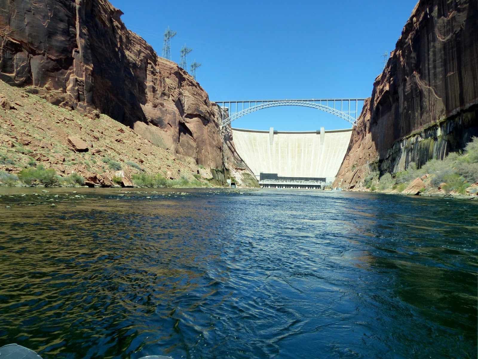
After going through a security gate, we drove to the base of the dam through a dark 2-mile long access tunnel. Sometimes all we could see were the dash lights from the bus and then there'd be a flash of light off to the left where we could see daylight.  Mostly it was just dark.  Once we were back out in the sunshine, we found we really were at the base of the dam.  It's a really big dam!
We had to put on some funky hard hats to walk from the buses to the water.  Apparently people sometimes toss stuff off the bridges.  I hardly think the hard hats would keep us from getting hurt, but it must fill in someone's checkbox.  (Manual of Cautionary Procedures for Tourists in Governmental Facilities.)  Looks a lot different looking up.
As each boat got full, they cast off and started down the canyon.
Our guide was Native American and he shared a lot about his culture, as well as interesting info about the dam and the canyon. At one point he sang to us in his language. That was pretty cool! 
 
Remember when I said that as we drove through the access tunnel, there would sometimes be a flash of daylight? When they built it, they didn't just cart the debris back out through the tunnel--they punched holes out through the side and dumped the fallen rock into Glen Canyon. Now those holes are used for ventilation.  I think it's pretty cool.
 
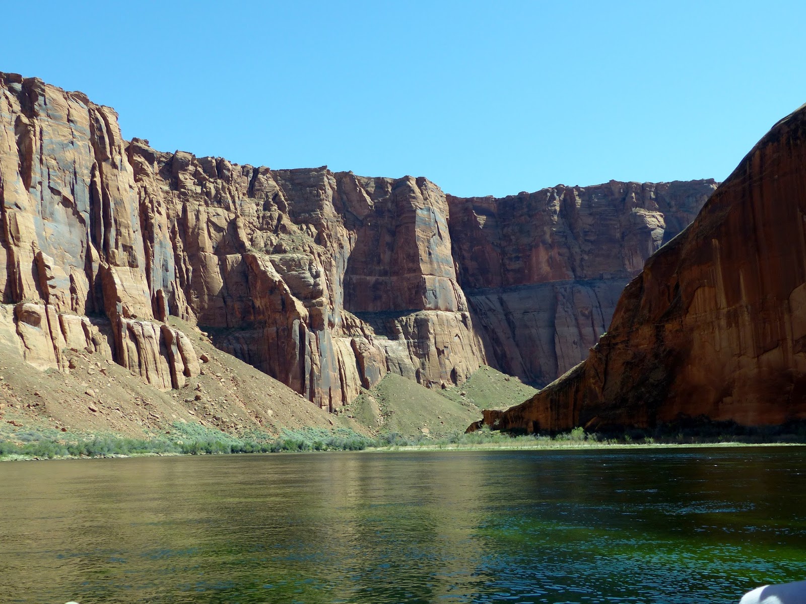
The rafts just float down the river, and there's hardly a ripple in the water. This is smooth, lazy rafting, not wet white water stuff.  The Navajo sandstone of the canyon walls comes in many colors.  The black coating is called "desert varnish" and is actually manganese oxide; the red and orange is iron oxide.
Our guide pointed a pair of ospreys out to us. I know there's a shortage of trees in the desert, but I don't know why these birds prefer nesting platforms to more traditional ledges in the rocks. Maybe these are modernistic birds of prey.
There's more shoreline than I expected, although in many places the vertical walls go straight down into the water.  If there's soil, stuff grows.  There's certainly enough water.
The guide showed us where there's a natural trail down into the canyon from the rim.  I thought he called it the Steps Trail, but it could have been called the Ropes Trail. He said it's about a mile and a half, and he used to take his kids when they were little, using the ropes that are strung to help across the really steep part.  Don't think I could talk George into that one!
We came around this big rock at a bend of the river where there were other rafts pulled up to the shore.  This was our rest stop, a chance for lunch, a pit stop, and a stroll past wildflowers to the Petroglyph Panel to view the petroglyphs.
 
Back to the boat and then downriver to Horseshoe Bend. Just to the left of the middle are people who hiked up the dune so they could look down on the dramatic bend in the river. Looking up at the tiny people up on the rim isn't quite as impressive as looking down on the boats in the water.  (Horseshoe Bend 2012)  We went around the bend just past a sandy campground and then we twirled a bit in the water, for those who could figure out how to do a 360 panorama with their cameras. That wasn't me.
We'd spent a little too much time on the river, so we had to hustle a bit going up river. Apparently these guys in the other raft had to catch an earlier bus because they blew past us.
Then it was back to the dam, back to the bus, back to the store, then back home.  Start to finish it was over 4-1/2 hours. Think we got our money's worth on this one!

More pictures (yes, really!) of the Colorado Raft Trip.

April 21, 2016

4/1/16 - Bucktank Draw Hike

First I have to tell you that I have no idea where Bucktank Draw really is.  I don't mean I really don't know where it is, because obviously we couldn't have done a hike if we couldn't find it.  I just don't know which branch of the park service stakes claim to it.

We were staying in Page, Arizona, crossed the Glen Canyon Dam over Lake Powell (Glen Canyon National Recreation Area) and stopped at the Carl Hayden Visitor Center for hike suggestions.  Listed on the back of the sheet under Regional Hikes Outside of Glen Canyon, Hwy 89 North is Bucktank Draw.

Then we drove a few miles into Utah, and stopped at the Big Water Visitor Center (Grand Staircase-Escalante National Monument).  On the other hand, when I look at a map, there's a bit of Utah state land surrounded by Glen Canyon NRA, GSENM and Vermillion Cliffs National Monument. So I say I haven't a clue...Actually, I'm not even sure if there's a difference between a draw and a wash.

Wherever we were, we followed the directions and parked at the west end of the metal railing on the south side of US 89, between mileposts 9 and 10. There's a gate to pass through before you reach the wash.
This is the draw, and maybe a wash; either way, it's really sandy.  Really hard to walk in.  Really tiring.
Occasionally there's a little patch of slickrock.  Slickrock is the flat rock that's been smoothed by wind or water--maybe sand here. It's not really slick unless it's wet or has a little bit of sand on it. No water here, but occasionally some sand on the rock.  Mostly it's a lot less tiring than walking in the heavy sand, although George kept telling me to be careful. (I'm afraid I'm going to be a little whiny today--I was exhausted by the time we finished.) 
We had to go through some barbed wire strung across the wash.  Not a big deal because it was already broken.  Don't know if it was by people or cattle, but I'd give the cows the benefit of the doubt here.  I went up and around, George went under.
In some sections the walls of the draw got a little higher, and sometimes they had a lot of color.  It would have been more interesting if I'd been a little less uncomfortable.
They call these "pour-offs", where the water flows off a rock edge into a pool below.  Sometimes you go up, and sometimes you go around.  I took this shot after I'd already climbed up.
This one was easier to go around on the sandy slope but I had to check it out first.
Here's another pour-off that George is climbing up.  He doesn't much like the climbing; I don't much like the sand.
The water does different things to the rocks when it floods down the wash.  I don't know what it's called when it makes little columns like these. 
Here's another section where we had to go around.  We had to go up another sandy slope before we could get on the slickrock to take us around and then back down.
Like this one...by now whenever I saw more sand, I was not very happy.  My legs hurt, my shoulder hurt, I was tired and feeling pretty crabby.  George was doing just fine, so I had to keep up--and try to keep shut up.  Obviously I should have done more walking last winter.
You're supposed to go 1.5 miles up the wash to be able to see Birthday Arch.  And that's just to see it, not climb up to it.  Across from the arch,on the opposite side of the canyon, is a slot canyon well concealed in the canyon wall.  We didn't go close enough to see the arch very well, and I'm not sure I saw it at all.  George took this picture.
Since I pooped out and didn't want to go closer to the arch, we obviously didn't see the well concealed slot canyon.  We did traverse around this little tiny thing back down the draw.  I'm calling it good.  I just wanted to head back to the truck, which I figure is now about 6 miles away.
At least it's downhill.  
More pictures of Bucktank Draw.