April 30, 2016

4/18/16 - Union Station Museums

After we’d gone to Golden Spike National Historic Site, we headed back to Ogden, Utah.  Keeping to the train theme, we visited The Museums at Union Station at the (guess where!) old Union Train Depot. Some friends had been there last year and suggested it to us. The station was built in 1924 after the 1889 building burned down.


During its peak, 120 trains a day moved through Ogden, with 17 tracks just for passenger service.  I assume there were more than these few wooden benches for all those people!
Now the old station houses four separate and unique museums with exhibits on trains, guns, cowboys and cars--pretty much something for everybody.  (Well, maybe not, but I figured I’d give it a shot.)

First up was the Utah State Cowboy and Western Heritage Museum, just a big room dedicated to Utah cowboys (and cowgirls).  There's 
As you’d expect from the location alone, the Utah State Railroad Museum is the biggest one. There’s a big display on the transcontinental railroad...just in case you weren’t paying attention at Golden Spike.

They have the safe where the original Golden Spike was stored for years after an earthquake damaged the museum at Stanford University where it was on display in California. Right now it contains the Utah Centennial Golden Spike on loan from the Utah State Treasurer’s Office.
The Wattis-Dumke Model Railroad exhibit has scale model scenes of local terrain with lots of model trains running constantly. (I liked this part best.)
Outside in the Spencer S. Eccles Rail Center are vintage locomotives and other train cars and cabooses. There’s even an old steam powered snow plow, although I’m pretty sure this isn’t it.
Back inside, we headed upstairs to the John M. Browning Firearms Museum.  George liked this one, of course.
Little bit of atmosphere here, with dim lights except for the bright lights in the individual displays although it didn’t make me want to run out and buy a camo jacket. There had exhibits about the Browning family, the history of the different kinds of guns, prototypes of shotguns, and other things I had to ask George about. Apparently many of the basic mechanisms of modern firearms were first invented by Mr. Browning.  That’s what museums are for.
 
Last up was the Browning-Kimball Classic Car Museum, another one where George left drool tracks.  Oldest car is a 1901 Oldsmobile with one cylinder.  There are a lot of cars with running boards and huge fenders.
 
Check out where the rear view mirror is on this one!  I have no idea what you’d do with it if you had a flat.
Four things I learned at the museums today:

  1. The 2013 Miss Rodeo America is from Utah.
  2. Cabooses were made obsolete by a EOT device--an End of Train electronic box that monitors the train from the last car.  
  3. Browning made a gas-operated machine gun in 1890 that fired 600 rounds/minute.
  4. Side rear-view mirrors were originally mounted on fenders and held on by leather straps.

That's enough history for the day...time to go eat!
Oops--not yet....
Look at the Wasatch Front to the east.  Pretty.
Now it's time to go eat!

For more pictures of the stuff in the museum, click here: The Museums at Union Station 

April 28, 2016

4/18/16 - Golden Spike NHS

You probably remember this place from American history classes. Golden Spike National Historic Site at Promontory Summit, Utah, is where the last spike was driven for the transcontinental railroad. This was a really big deal in 1869, not much going on there now.


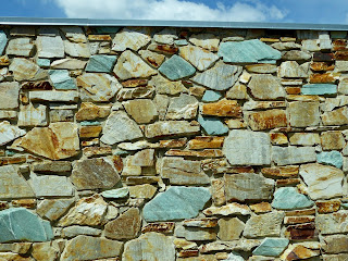
We drove across the tracks, then went to the Visitor Center.  There’s a plaque out front with some gooey language about the event.  They used rocks from a quarry near Park Valley, Utah, for the building.  I was fascinated with the green stone—it’s cupreous (copper) quartzite.

Inside, the Ranger showed us the difference in the size of the railroad spikes between 1869 and 1969. It's a cool display, but I'm not quite sure what the point of this was.  I don't think it was simply that it would take more gold for a spike now.  Probably had something to do with the weight of the trains, but I'm not really sure. George probably paid more attention than I did...maybe you could ask him.
We watched the video.  Wandered around the museum.  Learned more than I expected. I’ll share...

Both the Central Pacific Railroad from California and the Union Pacific Railroad from New York broke ground in 1863 to join the country with a transcontinental railroad. 

They had to survey and grade as well as build tunnels and trestles before they could lay any track at all.  When they laid track, they got some pretty impressive subsidies from Uncle Sam. (Please don’t think that CP’s Leland Stanford and UP’s Thomas Durant were doing this for a publicity gimmick. This was for big profit!)

Supplies were a logistical nightmare because it took 8 flatcars of material for each mile of track. After the Civil war, they really started going—at a whopping 2-5 miles a day on flat ground.  Sometimes work parties on the Plains were raided by the Sioux and Cheyenne.  The Central Pacific had to have every rail, spike and locomotive 15,000 miles around Cape Horn!  (The mind boggles...)

By mid-1868 Central Pacific had laid 200 miles of track across the Sierras—and Union Pacific had laid 700 miles from Omaha. As they got closer together, greed got in the way of common sense, and the race was on to grade more miles for land subsidies.  One day in April 1869 set a world record.
They actually passed each other on parallel grades and went 200 miles beyond their railheads. Congress finally put a stop to that nonsense, drew a line in the sand and told them to meet up at Promontory Point.

This painting shows the way it looked for the ceremony.  That’s the Jupiter from Central Pacific  on the left and the Union Pacific‘s No. 119 on the right.  (There's better pictures of the trains below.)
They left a single rail gap for the symbolic Golden Spike, then the iron one was driven.  After that I assume the locomotives backed up.

This is a replica of the ceremonial Golden Spike.  The original is at the museum at Stanford University. (Leland Stanford, remember?)
Views of the track, both directions--just to show you that it really is out in the middle of nowhere!
On the anniversary of the event, they re-enact it with the locomotives nose to nose on the track.
The Ranger gave us directions to the Engine House, where they keep the replica locomotives.  (Out of the parking lot, down to the tracks, hang a right and at the house keep to the left at the fork...)  The tourist season starts Memorial Day weekend, so the crews inside were busy painting the trim and polishing the brass, getting the engines all spiffed up for the summer season. 
They had volunteers from Americorps and I got a chance to talk to some of the kids.  Americorps is sort of like the Peace Corps, only domestic rather than international.  They volunteer for national and community service and get sent all over the country to do all sorts of seasonal work at parks and other state or national facilities.  Pretty cool thing to do.  Wonder if they get college credit for it?

More pictures here:  Golden Spike NHS 

April 25, 2016

4/12/16 - Great Basin NP

We had originally planned to visit Great Basin National Park on our way north this year, but as we got closer, weather reports showed the highs would be down in the low 30s with possible snow--I wasn't very interested.  I cancelled the reservations I had at an RV park nearby, but at some point I realized the forecasts I was looking at were at the top of the mountain instead of lower by the caves.  We made it a day trip from Delta, Utah.

When we got to Baker, Nevada, the Great Basin Visitor Center wasn't scheduled to open for another 20 minutes. We figured we'd catch it on the way back from Lehman Caves.  We were a bit surprised to find another visitor center just a few miles down the road.  I think it's because Lehman Caves was a National Monument before it was incorporated into the newer National Park. My other theory is that the entire population of Baker (sign says 68 people) works at the park and someone's got a job with budget recommendations. They're making a wheelchair ramp at Lehman Caves Visitor Centers so the parking lot is a mess.
           
Great Basin Visitor Center
Lehman Caves Visitor Center

One of the displays is about an old rifle from 1873 that was found by park archaeologists in 2014, just leaning up against a tree. No one knows who left it, or when. Rusty and weathered, they call it "The Forgotten Winchester". When they found it, it apparently went viral on Facebook, but since I don't do Facebook, I didn't notice.
After the standard screening for White-Nose Syndrome in bats, we got tickets for the Grand Palace Tour. Since we had almost two hours to kill, the ranger suggested a drive on Wheeler Creek Scenic Road up to the Osceola Ditch. The road to Wheeler Peak was closed beyond that because there's still snow.  We wouldn't be able to see the ancient (as in 3,000 years old!) bristlecone pines.


As we passed one of the campgrounds, we saw a whole bunch of wild turkeys strutting their stuff. I guess it impressed the other toms. Actually, it impressed me...
The Osceola Ditch is an 18-mile aqueduct used in the late 1800s for gold mining. The ranger thought we'd be able to hike up it a ways, but there was too much snow.

What I really came to see was the Caves. Not sure if that was what George was interested in because he always has to duck a lot in caves. (Oh, what a difference 12" makes!)

This is a really cool cave!  There were only 9 people on our tour so we didn't have to deal with the crowds we'd been with in other caves.
It's obviously not as big as Carlsbad or Mammoth, but the decorations are gorgeous.  You can get really close to them too.  I was able to take better pictures with this camera too. Here are a few examples:


After the cave tour, we stopped at the other visitor center where the focus is on the entire Great Basin, not just the park.  I tease George all the time about not remembering anything from his Washington State History class in high school, but I took Nevada State History and had a little memory problem myself. I remembered that it encompassed most of the state but didn't know it was in other states too. I remembered rivers disappeared underground but I'd forgotten there was no outlet to the ocean or the Gulf of Mexico. I definitely didn't know Nevada is the most mountainous state in the country! (Yet another example of how educational an experience our trip is.)
On the way back home, we stopped at the Shoe Tree we'd noticed just outside Hinckley, Utah. There were a couple of girls trying really hard to try to get their shoes to catch on the tree.  Not quite as easy as you'd expect. 

(This tree and other quirky things can be found on http://www.roadsideamerica.com/ --an odd (and sometimes downright strange) website of tourist attractions.)

More pictures of Great Basin and Lehman Caves: Great Basin Natl Park 

April 23, 2016

4/7/16 - Zion NP (Revisted)

Zion National Park again?  (Zion National Park 2012)  There are just some parks that beg you to return.  (And a few that you wouldn't even if they did!) We were in southwest Utah for a week, so I gave George a choice of going to Zion again or going to Snow Canyon State Park. He opted for Zion.

Good grief!!  Barely April and already there's a traffic jam at the gate.

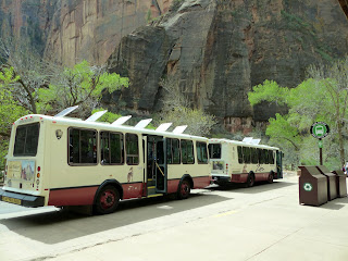
There are two shuttle routes:  one from Springdale into the park, and another on the Zion Canyon Loop.  We rode the park shuttle to the end, took some pictures, then rode another one back to the stop at The Grotto to start our hike.
We'd hiked to Emerald Falls before, but had never gone beyond the lower pool.  We decided to take the Kayenta Trail up to the upper pools, then loop back down another trail back to Zion Lodge. After crossing the Virgin River and taking the requisite pictures of Angel's Landing, we turned left onto the trail.
The view is always dramatic and impressive in Zion, although this day the sky wasn't always as cooperative as I'd like.  As long as I'm looking up anyway, I want perfect blue sky as background. 
Total elevation gain is only about 350', even to get to the Upper Pools.  The round trip loop is about 3 miles, so that's not bad--even for old people like us.  There was a steady stream of people heading up and back down.  Here we were on one side of a little canyon and could see across to Lower Emerald Falls--that would be the bottom ridge where that black smudge is in the picture.
Eventually the Kayenta Trail met up with the Emerald Pools Trails-- plural because there are three levels, whimsically named Upper Pools, Middle Pools and Lower Pools.  We continued up the Middle Emerald Pools Trail. This is another view of the Lower Emerald waterfall, still from a long ways away. This time you can see the water running down the black smudge in the middle. 
The pictures I've chosen don't show all the people that were on the trails.  Some were going the same way we were, but as many were coming back.  Eventually, climbing up steps, then going down others, we ended up at the Middle Emerald Pools, where we shouldn't have been surprised to see the crowds of people. 
We wended our way through the throngs and continued to where we could actually see the pools. That's plural again because there are two Middle Emerald Pools.  Continuing with the naming convention, one is the Upper Pool and one is the Lower Pool.  Haven't a clue which one they call this, but it's pretty. 
Above one of the middle pools is a waterfall--it's another black smudge just below the notch.
It's only another .3 mile to the Upper Pool.  When you get there, there's a barricade to help cut down on the tourist mortality rate.  
That's the pretty view. Directly behind you is the Upper Emerald Pool, not quite so nice.
We were planning to take the Middle Emerald Pools Trail from here down to Zion Lodge, but heavy winter floods washed part of it out.  That meant we had to backtrack to the Middle Emerald Pools and go down that way.  The trail leads under Lower Emerald Fall. This is one of the few places where there are railings. 
The other trails were rocky and unpaved. The Lower Emerald Pools Trail is paved, and it's a little over 1/2 mile down to Zion Lodge across another bridge over the Virgin River. I stood on the bridge and took a picture up river, then turned around and took another one.
 
Would I come back to Zion?  Of course.  But before I do, we're going to Snow Canyon State Park.

In the meantime, click for more pictures of this trip. Zion Natl Park