May 31, 2013

5/30/13 - Niagara Falls

Everybody's seen pictures of Niagara Falls.  Everyone knows they're big.  Everyone knows they're impressive.  I didn't know they would be so loud.  I didn't know they created so much wind!  I also didn't know they were in a New York State Park (cleverly named Niagara Falls State Park.)  And I certainly didn't know that this state park--that I didn't even know was a state park--is the oldest state park in the country (1885).
We bought Discovery Passes so we could do everything.  We wandered around the edge for a bit, looked at the American Rapids and American Falls.   They're doing some construction on Lumi Island, so you can't get down to where you're right on top of the falls.  There's mist everywhere!
They give you a bright yellow rain poncho to wear.  It might not keep you dry, but if you fall the other tourists will be able to see it and take lots of pictures for the evening news.  There are also cheap sandals so you don't slip.  Your own shoes go in a plastic bag that might keep them dry.


You go down in the elevator so you can climb up again.  The Cave of the Winds has been gone since 1924, so the name is obsolete.  Instead of a trail behind Bridal Veil Falls, there are a series of stairs and decks that take you in front of the waterfall.
The rocks between the river and the walkway are covered with nesting Ring-billed Gulls.  It's like being in the middle of a Discovery Channel show.  However, I now understand why seagulls aren't afraid to be around people.  They hatch right next to the path, with hundreds of people gaping at them all day long.  With that much attention, any initial shyness has been negated.
The decks are spread all over the place, high, low, beside the falls, in front of the falls (American Fall on the left; Luna Fall on the right).  The highest deck is called the Hurricane Deck, with wind speeds generated by the power of the water up to 65 mph.  That's where the poncho whips and rips--and you get drenched.  We didn't go quite that high, but it was still pretty impressive.
We took the trolley to Terrapin Point to see Horseshoe Falls from the top.  Check out the water action as it's getting ready to go over.
Next we headed over to the Observation Tower to see the falls from above.
Time for the Maid of the Mist tour.  We got blue ponchos that were even thinner than the yellow ones.   


The boat takes you to the base of American and Horseshoe Falls.  You'd need a waterproof camera to really get good pictures!  The water was blowing so hard into my face when we got close to Horseshoe Falls, I could barely keep my eyes open!  And the noise was unbelievable right there...
We picked the absolutely perfect day to go.  We got there before peak tourist season in June, so no crowds, no lines, no waiting.  It was a warm and sunny day, so the sky and water were blue, and we dried off quickly.  The wisteria and locust trees were in bloom, so the whole park smelled wonderful.

For lots more pictures of the waterfalls:  Niagara Falls State Park  (Let me know which one you like best.)

5/29/13 - Erie Canal Cruise

Low bridge, everybody down.
Low bridge for we’re comin' thru a town.
 
Remember the Erie Canal song?  I learned it in grade school--drives me nuts I can only remember part of one verse, and some of the chorus.  (Wait!  Why should I apologize for not remembering a song from 1956???  Good grief!  It’s not an Alzheimer test!) 

The official name of this boat ride is Lockport Locks and Erie Canal Cruise.  We went with Captain Mike on the Lockview IV for a 2-hour tour of the canal. Captain Mike has a great spiel about the history of the canal and things we saw.  (George told me later that he’d pulled something up on his cell phone and read every word.  I suppose that explains why when I asked him a question, I usually got a one-word answer.  But occasionally you could tell that he had a wicked sense of humor.  Probably just bored with all the tourists—he’s been doing this for 27 years.)


The Erie Canal in Lockport, NY, is along the "Erie Canalway National Heritage Corridor", so George got to get a Passport stamp.  This is the real Erie Canal—363 miles dug by hand between 1817-1825, from Albany to Buffalo--which opened the frontier for migration west.  I think that's why so many people ended up in Minnesota.   
 
We headed west until we got to Locks 34 and 35.  These 2 locks are the modern side of the canal.  Half of the original Flight of Five locks from the 1800s are still there.  On the right, they're used as a spillway now.  Left of the white building is the current canal.  The white building used to be a control structure for Gates 34/35, now it's the Lockport Erie Canal Museum.
 
 
We tied up in Lock 34.  They closed the gate behind us, and raised the water. 

When it was high enough, that gate opened and we went into Lock 35. 
See the water spraying?  That’s actually several leaks in the gate.  Captain Mike told us we wouldn’t notice them when the water level came up.
When the water was high enough, went out the Gate into the canal and headed to the widest bridge in the US.  Under the bridge you can see where the old tow path goes on top of the stone cut.


Mostly you can’t see the towpath alongside the canal …  At this point they cut a lot of the vegetation away, and discovered a stone building that no one knew was there.  They have no idea when it was built, who built it, or what it was used for.  Apparently they didn’t ask the right people.  Somebody's gotta know!
We turned around to head back to town.  We “locked through” Lock 35, then 34.
 
We cruised under the Upside-Down Railroad Bridge, built to discourage large ships from using the canal.  Sneaky way for the railroads to get them to transport cargo by rail.  Captain Mike took us past the dock to turnaround at the Lockport Marina and cruise back.  Fun day. 
Click for more pictures of the Erie Canal Cruise.
 

May 30, 2013

5/27/13 - Cuyahoga Valley NP


Cuyahoga Valley National Park is unlike any other national park we’ve visited.  For one thing, it’s an urban park, near Cleveland and Akron, Ohio.  There are homes and even towns within the park.  For another, it isn’t protecting a unique geological feature in the US, like Yellowstone or the Grand Canyon, which is my idea of a national park.

This park was established to protect an area where the Ohio & Erie Canal USED TO BE.  The canal was destroyed by a huge flood in 1913, but trains had mostly replaced the boats 50 years before.  Mostly what you see is the towpath where the mules walked when they pulled the boats along the canal.  Occasionally you can see a sunken area in the grass where the canal was—check out the picture:
Personally, I think it should be designated a National Historic Site; I’d even go for National Historic Park, but definitely not a National Park.  It was created as a National Recreation Area in 1974, and in 2000 it was upgraded to NP status.  I have no idea why…  (If you’re a Buckeye, go ahead and let me know what you think; I can take it!) 
Interestingly, it’s one of the Top 10 most visited national parks in the country—probably because it’s so close to big cities.  It’s a great place to ride a bike or hike along the towpaths, and edging one side of the park there’s a metro trail.  There are trails for horses, and even a couple of ski resorts right in the park!  (It’s Ohio, remember?  Don’t think mountain; think bunny hills.)  There are even four golf courses in the park.
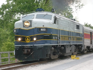
The Cuyahoga Valley Scenic Railroad runs through the park along the Cuyahoga River (an Indian name for “Crooked River”), with locomotives and passenger cards circa 1950s.  We rode the train from Peninsula Depot Visitor Center up to Rockside Station, then back.  That was fun—and since the weather was a little iffy, it worked out quite well.
 
The kids on the train loved it when we passed Thomas the Tank Engine—there’d been a special event with the blue steam engine during the Memorial Day weekend. 
After our train ride, we drove back to the Boston Store.  The restored store from 1836 is now a Visitor Center.  (The Canal Visitor Center is closed for renovations, so we didn’t learn much about the canal.  I’d gone with the song about the Erie Canal in my head, so I started off in the wrong state.)
There’s a boardwalk trail to Brandywine Falls—second highest falls in the state at 65’!  (I already said it’s Ohio—it’s a really flat state!)  By then it was drizzling a bit, but it was a short walk and definitely worth it!  Best view is from the Lower Observation Platform.
  

More pictures at Cuyahoga Valley

5/25/13 - Covered Bridges in Ohio

Ashtabula County calls itself the "Covered Bridge Capital of Ohio".  There are 18 covered bridges in the county, including the longest and the shortest in the US.  Before you read further, see how much you know about covered bridges.   

 
COVERED BRIDGE QUIZ 
(Answers Below) 
1.  Why are covered bridges covered?
          a)  To make good tourist attractions
          b)  To prevent ice from forming on the flooring
          c)  To protect the trusses in the ceiling
 
2.  How long will a covered bridge last?
          a)  20 years
          b)  100-200 years
          c)   Don't have a clue, but probably indefinitely.
 
3.  What are covered bridges made of?  (Don't cheat and look at the pictures!)
          a)  stone
          b)  wood
          c)  concrete and steel
 

 We went on the self-guided bridge tour.  That means George drove the "tour truck" and I read the Covered Bridge Tours Guide out loud.  We checked out 10 of them, including the longest, but not the shortest in the US.
The historical ones had Town Lattice construction and were built with big wooden pegs. 

Most of them have been renovated, adding laminated arches, like this one.  Or maybe concrete piers.  If I'm going to drive on a 150-year-old bridge, I prefer it renovated so it doesn't fall down while I'm on it.  (Oh, wait!  We did drive on these bridges.  None of them even creaked.)
Oddly enough, they're not all from the 19th century.  It seems that Ohio is still building covered bridges.  I don't know about other states. 
Netcher Road Bridge, built in 1999, 110' long, clearance 14'6"
 You can't drive across this one anymore, but you could have a picnic inside.

     
Graham Road Bridge, built in 1913, 97' long


And here's the longest covered bridge in the US. It was built in 2008(!)  Engineering and structural design was done by the former County Engineer, and architectural design by the current County Engineer.  Personally, I think they just like building bridges and their hobby is paid for with taxes.
Smolen-Gulf Bridge, 613' long
  
ANSWERS TO COVERED BRIDGE QUIZ 
 1.  c)  To protect the trusses in the ceiling.  What they really want to protect in a covered bridge is the superstructure--the trusses. Made of heavy timber before the days of treated lumber, these are the expensive part of the bridge.  If they rot due to exposure to the weather, the bridge falls apart.  One of the jobs of a bridge tender was to shovel snow ONTO the bridge surface so that horse-drawn sleighs could cross. 
 
2.  b)  A covered bridge will last 100-200 years, maybe more.  An uncovered plank bridge will last only 10-20 years.  Depends on the weather, how many heavy trucks cross, and whether some adolescent plays with matches.
 
3.  By now you've seen the pictures, so you know they're made of b) wood, whatever kind was handy where they needed a bridge.
 

Go here for all 10 of the covered bridges we saw.  Ashtabula County Covered Bridges