June 30, 2015

6/26/15 - Voyageurs NP

We went to visit our friends Larry and Ruth in Grand Rapids, Minnesota. They were going to take us to Voyageurs National Park in his boat, but George didn't want another experience like the Isle Royale cruise where we froze on the boat ride. The weather was iffy (then turned out to be beautiful, of course!), so George opted for a drive to a couple of the Visitor Centers so he could get some passport stamps.

There are three Visitor Centers, but we only went to two of them. The one in Ash River is in the historic Meadwood Lodge. The interior doorways aren't very high, so George had to watch his head.

The Voyageurs of Grand Portage National Monument were the same Voyageurs here, only here it's not the place for rendezvous, it's the middle of the journey. The fur traders would go as far north as the Athabaska country in what's now Canada, 3,000 miles from Montreal, most of it by water. The area the park covers is through several lakes: Crane, Sand Point, Namakan, Kabetogama, Rainy. There are more than 500 islands and 650 miles of shoreline, 340 square miles of land and water. We missed a lot not getting on the water. If we ever go back, that's what we'll do.

Next stop was Kabetogama Lake Visitor Center. There's a pretty public boat dock and a tiny glimpse of the kind of rocks you'd see on some of the islands. The four of us wandered around the little museum and then watched the video.
Just behind the Visitor Center is a beaver lodge built on the bank. I didn't even know they built lodges like this. As you can probably guess, we didn't see the beaver...
There were lots of wildflowers around there. (Check out the pictures on the link below.) On the way back to Grand Rapids, Larry took us back a different way. There were fields and fields of wild daisies. 
Then Larry took us to the Laurentian Divide. It's a ridge that directs the flow of the waters in Minnesota. All the streams and rivers on the north of the Divide flow into Hudson Bay and to the Arctic Ocean. Everything south flows to the Mississippi and the Gulf of Mexico. I'd never heard of it! I can't tell you how many times I've crossed the Continental Divide which splits the watersheds that flow into the Pacific on the west and the Atlantic on the east. But North? Who knew?

More pictures at this link:  Voyageurs Natl Park

June 27, 2015

6/19/15 - Isle Royale NP

Isle Royale National Park is closer to Minnesota, although the islands are considered Michigan and the official Visitor Center is in Houghton, Michigan. If you go on the boat from Houghton, you have to stay overnight and the hotel cost is pretty high. It's also quicker and cheaper to get there from Minnesota. We took a day trip out of Grand Portage on the Sea Hunter III.


There's a $4 Park User Fee that isn't included in the boat ticket so you have to either pay it separately on-line or line up to pay it when you get there. The boat leaves at 7:30 am and it takes about two hours to get there. Of course, I wanted to sit outside.

There's an old twisted tree standing on a rock on Hat Point as you leave Grand Portage Bay called Little Cedar Spirit Tree. The Ojibwe hold it sacred and sometimes they leave tobacco to ensure a save journey on Lake Superior. I'm not sure why a tree would want tobacco, but that's what the guide said.
It must work because the lake was unbelievably smooth. Doesn't look like it's only 39 degrees though, does it?
As we arrived in Washington Harbor, the captain took a little detour so we could see the shipwreck of the SS America, a passenger steamship that sank in 1928. It's sitting at a steep angle but you can get a glimpse of a white bar and a shadow under the sparkly water. I couldn't see any more than that. There's more info about it in the Visitor Center, which is a little more interesting than this. Apparently people go to the park specifically to dive this wreck, but let me repeat that it's only 39 degrees down there!
When we actually got to Windigo, there was a Ranger waiting on the dock for us.  Actually, she wasn't a Ranger, but an intern. There were at least three college girls, working there for the summer. They handled the interpretive talks and the Visitor Center, using lots of notes and admitting when they didn't know the answers, which was fairly often. I don't think we ever did see a Ranger. Oh, well, maybe they were off riding herd on the moose and the wolves...doing their job keeping them away from the day trippers.

Since we only had a few hours on the island, we opted to learn as much as we could by going to the interpretive talks. Actually, the first one was also an interpretive walk along part of the Nature Trail through the "moose-free" enclosure, which of course, had no moose because they were with the Rangers. There we could see the difference in trees that were allowed to grow naturally and the stunted ones that were chomped on by hungry moose in the winter. (Check out the clipboard--she has a script and read everything to us.)
Between talks, we had a few minutes to wander down another trail and stopped to watch a float plane arrive. That's another pricey way to get to the island.
Next talk was about moose. You can probably tell we didn't see a moose here either. This intern did at least know a little more about her subject. It was a really good talk for the kids in the group...oh, did I mention there weren't any kids in the group?
The last talk was given by yet another intern, only this one was REALLY good! She talked about the history of the hotels and lodges that were there before NPS bought the islands. She was knowledgeable, enthusiastic, funny and made it interesting for all of us. It was a bit of show-and-tell too but George got to play Walter Singer and read the card about his fancy hotel The Island House.
Not much left of any of them now--this is all that's left of the John's Hotel. It's not on my bucket list.
When it was time for us to leave, all the interns lined up on the dock to wish us Bon Voyage.
On the way back to the mainland, the boat captain took us past the Rock of Ages Lighthouse. Pretty impressive thing on that little chunk of rock, but lighthouse keeper is another job that would have been on my "Careers I'm Not Interested In" list.
Apparently only about 20,000 people a year go to Isle Royale. (Which BTW is not pronounced like it should be--the locals totally ignore the "e" at the end, so it's just royal, not royale. I'd been saying it wrong for months.) I can understand why more don't come--it's difficult and expensive to get to. What I can't understand is why everyone thinks this is such a beautiful and unique national park. I really hate to sound like I'm bragging about home, but I think the San Juan Islands in Washington state are prettier, easier and cheaper to get there on a ferry, have a more impressive history and there's more to do too. (Apologies to my friends from Michigan and Minnesota.)  

More pictures here:  Isle Royale Natl Park 

June 25, 2015

6/18/15 - Grand Portage NM

Once again we stayed at a casino RV park near the shore of Lake Superior, way up in the arrowhead of Minnesota, just a few miles south of Canada. (I didn't know they call it the "arrowhead". I just kept referring to it as the "pointy part" until someone laughed at me. What are friends for???) The view wasn't quite as good as last time, but we were up on a hill overlooking the Marina so we could still see the lake.
The campground was close enough to walk to Grand Portage National Monument.  The Voyageurs were the French Canadian "travelers", the workhorses of the fur traders. They'd pick up furs from the trappers, then transport them to the trading posts. Most of the time they used canoes, but when there were rapids or waterfalls, they had to portage the boats and bundles around.

The voyageurs had to carry two 90 lb. bundles of furs (and the canoes) overland through the woods! The Grand Portage was about 8 1/2 miles from Fort Charlotte to Lake Superior. George and I wouldn't hike that far without packs. We are such spoiled wimplings now.

The Heritage Center is a joint project between the NPS and the Grand Portage Band of Lake Superior Chippewa. It has exhibits about the history and culture of the Ojibway people (another word for Chippewa) as well as the fur trade. You can learn how to make a birch bark canoe or basket, or weave cedar mats, or make porcupine quill birchclouts and beaded and embroidered gauntlets. For some reason, I just looked at the displays this time and didn't read the how-to's. Sorry...
After oohing and ahhing over the craftsmanship in the display cases, we headed outside and across the road to the historic site. They've reconstructed the North West Company Fur Trade Depot, which was the summer rendezvous point for the voyageurs and fur traders.

First you walk through the Ojibway village. I don't know where they got the birch bark, but I know the trees around here aren't as big as they would have been back then. I don't know where they lived in winter, but these look like summer cottages to me.
The Canoe Warehouse has replicas of big birch bark cargo canoes. There are interpreters in costume who explain what's what and how and why.

The depot is behind a palisade, but they say it wasn't for protection. Maybe it helped block the wind off the lake.
In some places they've got the location of unreconstructed buildings marked with chunks of wood and unmown grass. It gives you an idea of the size and a chance to use your imagination about what it would have been like then.  History is like that--you can read all the facts about it but it all has to filter through your brain. The more practiced your imagination is the easier it is to recognize how it was. My imagination is pretty good, although I didn't see any bears in the woods around here.
The Great Building was the hub of the place during Rendezvous. There's a dining area, bedrooms for the company partners, shops and

The kitchen is in a separate building. The interpreter was able to answer my questions. Can't get over how knowledgeable the volunteers are in all the parks!
I asked about the birch bark cone, and she popped it off to show me a sugar loaf, which is the way sugar was sold during Colonial times. After processing, they put it into molds. (The cones were such a familiar shape a lot of conical mountain peaks around the world are named "Sugarloaf".) The metal tool is a sugar nipper. First you break a piece off with a hammer, then you use the nippers to make smaller pieces, then you use a mortar and pestle to grind it down to granulated or powdered sugar. (The wimpling comment holds in the house too. I'm really glad we don't have to do this.)
After exploring inside, we went down to the wharf, through the Voyageurs encampment and back to the campground.
 
More pictures here: Grand Portage NM

June 23, 2015

6/15/15 - Apostle Islands NL

We stayed at a campground right on the shore of Lake Superior in Red Cliff, Wisconsin. I missed the sunrise, but this was the next best thing. George missed both, so I hope he enjoys the picture...
The Visitor Center for Apostle Islands National Lakeshore is in Bayfield, Wisconsin, in the old county courthouse. It's still an impressive building but there was no time to explore or even see the video.  We had to catch a boat because the park is on the islands, with only this building on the mainland. The park isn't just the lakeshore around the islands, although that's what most people see.

Apostle Islands Cruises is the official concessionaire for the park, and this early in the summer, the Grand Tour at 10 am is the only option. They did have two boats going out that day, and I picked the older Island Princess because I liked the cheery red trim.  And of course I picked the top deck because the sun was shining. Unless you have your own boat, the only way to see the 22 islands in the Apostle Islands archipelago is on a cruise. (I thought "archipelago" meant a bunch of rocky islands, but these have trees. I'm not always right.) 
Bayfield's a pretty town right on the bay, all touristy and full of pretty houses and boats.


It was an absolutely gorgeous day to be out on the lake: sunshine, smooth water, blue sky, white clouds to keep the interest up between islands. Sunshine is most important, of course, but smooth water's high up on the list too.
Madeline Island is the closest island to Bayfield and part of the archipelago, but it's not part of the park. If you want to go, there's a little ferry that crosses the channel. The closest island in the park is Basswood Island. (The cruise brochure has a little map of the route we were taking, which helped me immensely when I was labeling pictures, even though I didn't do it soon enough and some of them remain nameless. They pretty much look the same anyway, so I guess that doesn't matter.) We went out on the east side of Basswood, back on the west side. We didn't get close to each one of the islands, but the captain pointed out the ones way in the distance and told us interesting little things about them. As you can see, we did get pretty close to Basswood. 
Off the northeast shore of Basswood is a standing rock called "Honeymoon Rock".  Apparently the seagulls nesting on top didn't wait to start their family since they made a nest on their honeymoon.

Sometimes we didn't get very close at all. And sometimes I don't have a clue which island is which, although I'm pretty sure one of them is Michigan. Oh, well...it's still a pretty day for a boat ride. 
Manitou Island has an old fish camp that started back in the early 19th century. 
I think this little sand spit is on Otter Island. 
My favorite island was Devil's Island, which is obvious when I started looking at the number of pictures I took of it. It has lots of sea caves and honeycombed sandstone cliffs along the northern shore, so it's a lot more interesting than the rest.


It also has a lighthouse.
The shape of Bear Island is supposed to look like a bear. If you have a really good imagination like I do, you can sort of see it, although I'd say it looks more like a skinny seal with a long tail. (Interesting fact about the Apostle Islands--because bears are good swimmers, they might be on any of the islands. Another reason we're on a cruise instead of in a tent.)
Raspberry Island has a lighthouse too. The house part is actually a duplex for the lighthouse keeper and assistant keeper and their families. 
We saw fishing boats and a few sailboats, but this one cracked me up! Apparently the family is going camping and fishing and biking and boating and anything else they want.
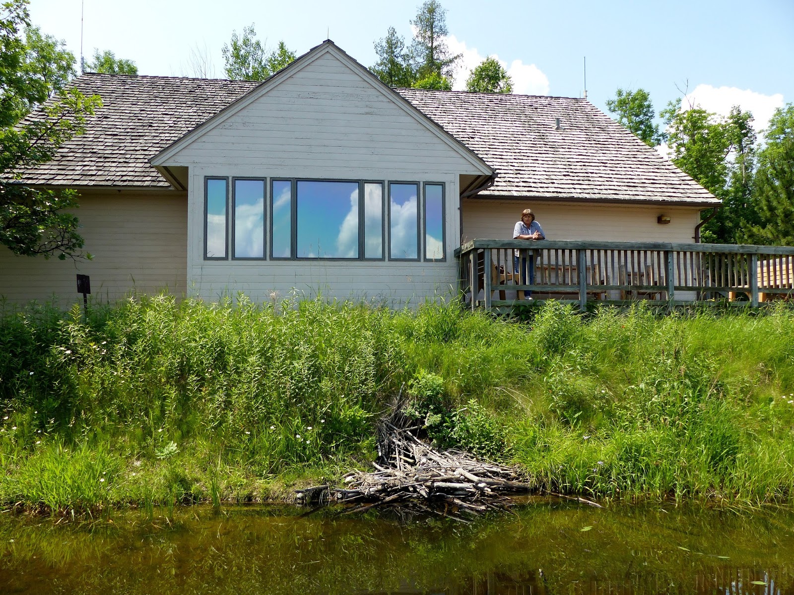
Ater we got back to Bayfield and had lunch, we went to the Northern Great Lakes Visitor Center in Ashland. They have passport stamps there because the NPS is one of the partners of the center. They have an Exhibit Hall, a photo display and a big mural with lots of detail about life in the North Woods. The view from the top of the tower is of the marshes and farms surrounding the center.. 
 
And on the way back to the RV, we went past lots of wild lupines. Pretty, pretty, pretty.
Frankly, I think that except for lighthouses and rocky cliffs, the Apostle Islands are ordinary flat islands covered with trees in a great big lake. Pretty, but I'd rather take a ferry to the San Juan Islands in Washington State. 

More Apostle Islands pictures: Apostle Islands NL