August 31, 2014

8/28/14 - Warhawk Air Museum

George’s cousin Ernie told us about the Warhawk Air Museum in Nampa, Idaho.  It’s in a big hanger at the Nampa Municipal Airport.

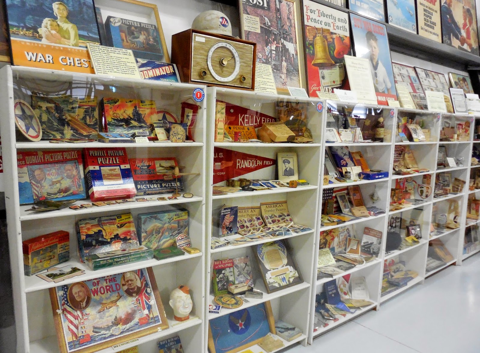
I’m not sure what I was expecting, but it wasn’t quite like this.  I knew there’d be airplanes, but there’s a lot more than that.  There are planes and posters and photographs, medals and models and munitions, books and banners and bombs.  
Thousands of personal collections of memorabilia as well as wartime memories have been donated to the museum.  It would take weeks if you stopped to read all the displays and exhibits they have.  I just wandered and when something caught my eye, I’d read a bit before I moved on to something else. There are all sorts of things that you wouldn't usually see in a museum.  Sure, you'd see uniforms, but maybe not games, or personal mementos.  You don't get the feeling that people just cleaned out their attics, but that this was a suitable place for their veteran's story.  
 
 
I liked the practice kites.  George told me they'd use them for target practice, just like they were real planes.  They had period music and old Jack Benny and Bob Hope radio shows playing in the background for ambiance.
There's a basket from an observation balloon and a German Fokker DR-1 tri-plane from World War I.

There are other things besides planes and military stuff.  Get two old guys together and they'll start talking old cars.  The cool hood ornament was on a 1930 Packard Eight. (The car behind it is a 1927 Studebaker Coupe.)  The red one is a 1941 Lincoln Zephyr V-12.  George took more car pictures than I did. (Honk if you're surprised!)  
They have a section with collections from the Cold War, including a Soviet MIG-21 and a MIG-17. The MIG-17 is missing it's wings from when it was shot down.  Looks really weird, doesn't it?
 
This cute little blue thing is an instrument trainer from WWII.  I think all the dials and switches are in an F-111 trainer.  We've come a long way, baby!
  
Because they were getting ready for an airshow this weekend, they were moving some of the planes outside.  
 
The pride of the museum (and where they got their name) are the two Curtiss P-40N Warhawks. Cool paint jobs--but I like the parrot one best.
 
More pictures?  Here you go!  Warhawk Air Museum 

August 30, 2014

8/23/14 - Shoshone Falls

I lived in Twin Falls, Idaho, when my kids were little.  Since it’s been almost 40 years, there had been a lot of changes.  (Really???  40 years?  How did that happen?)  

Shoshone Falls City Park is a must-see for tourists and ex-residents too.  There are even guardrails now.

Shoshone Falls has been an attraction on the Snake River since forever.  Called “the Niagara of the West”, it’s big and wide and at 212’, it’s 50’ higher than Niagara.  Not as much water going over as I expected after all the rains recently, but it’s still really impressive.  What I didn’t know is that the individual falls have their own names, including Bridal Veil and Sentinel.  
It’s been a city park since the ‘30s, but they’ve really made improvements, like trails and bike paths.  There’s an entrance fee now, but they let us use our National Parks Senior Pass.  The viewing platforms really let you see the falls from a better position than on the rim.
 
I used to waterski on the Snake upriver between Shoshone Falls and Twin Falls.  We’d put the boat in at the boat ramp, where the old ferry site was, and had a float our little group had salvaged that summer.   Our next-door neighbors were single guys, and they had a boat too.  They brought lots of girls and booze.  It was a ski party almost every day after work and weekends in the summer.  A few of us had little kids so it didn’t get too rowdy.  There are homes there now, so apparently it’s not state land. 
 
I was there in 1974 when Evel Knievel tried to jump the canyon.  There were 15,000 people there that day, on the south rim and down by the rock islands so they could see.  In retrospect, they were more entertaining than the actual jump.  Ours was the only boat on the river—we’d put it in on the north rim the day before.  We spent the day waterskiing with lots of friends ferried from the boat ramp over to the scavenged float we used on the other side (right about where that tall poplar is now.)  We watched the jump from the water.  I wasn’t terribly impressed.  If you look carefully, the jump ramp is visible on the picture below.  (It’s a dark strip on the downslope, top left.)  Apparently there’s a plaque, but they’ve got it all fenced off.  For posterity, I suppose...  
Since it seemed to be old-home week, we headed over to the Perrine Bridge, which spans the Snake River Canyon.  The brochure I have says it’s 1,500’ long, 486’ above the canyon floor.  The brochure goes on to say “This bridge is a popular destination spot for BASE (Building, Antenna, Span and Earth) jumpers throughout the year.”  I suppose it makes sense that the city that let Evel Knievel pull a stunt like the Sky Cycle wouldn’t have a problem letting people swing off the bridge deck.  As long as you've got a reputation for stupid stunts, you might as well go for it, I guess.
More pictures?  Click the link here:   Shoshone Falls City Park 


8/21/14 - Hagerman Fossil Beds NM

We got a double-bonus when we went to Hagerman Fossil Beds National Monument.  We ended up visiting two more famous historical sites, with no effort (or planning!) on my part.

When I originally started looking at national park sites in southern Idaho, I discovered Minidoka National Historical Site northeast of Twin Falls. When I read there's no visitor center, and not much of anything there anymore, I crossed it off the itinerary.  Imagine my surprise when I saw this sign at the Hagerman Fossil Beds Visitor Center:
It's just a little room behind the Visitor Center Desk with rotating displays that try to tell the story of the Minidoka War Relocation Center, one of ten internment centers where over 100,000 Japanese-Americans were confined during WWII.  It's a small exhibit, so there's just a bit of information about the race prejudice and fear hysteria that caused these poor people to be uprooted from their homes and shipped to isolated locations.  
The thousand origami crane mobile was created by 8th graders from Buhl, ID.  
Ranger Kary told us that a Visitor Center is planned to be opened at the old internment camp, possibly within a few years.  That would make it a lot more interesting than this little exhibit at Hagerman.  
Back out in the main room of the Visitor Center, I started checking out the fossils.  No dinosaurs, but animals like saber-toothed cats, camels and ground sloths were found in sediment layers of bluffs above the Snake River.  The most famous is the Hagerman Horse (Equus Simplicidens), which is actually the Idaho State Fossil.  (I knew states had state flowers and birds, but fossils?  Who knew!) They found 120 skulls and 20 complete skeletons.  Paleontologists say he's "the first true horse, but actually looks more like a zebra".  I need a lot more than bones to recognize a horse--or a zebra...  
Besides the horse, they also have some mastodon bones.  There's a skull (without jaw) and a foot.  (I did okay identifying this as a mastodon though, although if you'd told me it was an elephant, I could have agreed to that too.)
The mastodon foot is even bigger than George's size 15!
Good thing they have fossils in the Visitor Center, because, as we've come to expect, you can't see them anywhere else.  In this park, you can't get anywhere near the fossil beds.  However, Kary, our favorite ranger, gave us a self-guided tour map and explained what to look for at the various stops, including how to identify the tracks we'd see.  We stopped first at the rest area adjacent to the Hagerman Wildlife Management Area for lunch.  It was Stop #2 on the map--the Visitor Center was #1.
Just past the rest area, there are huge boulders on both sides of the road.  They're called "melon gravels" and are chunks of basalt tumbled and left behind by the Bonneville Flood.  Bet the farmers love 'em!  
Stop #3 - We stopped at the historic Owsley Bridge, a one-lane suspended span metal bridge built in 1920. It's on the National Historic Landmark list--you can still drive across it.  Slowly.
Stop #4 is the Snake River Overlook.  They used melon gravel as parking barriers. Clever use of geological phenomenon.  And I bet the farmers don't mind.
The fossil beds are somewhere across the river in those bluffs.  
Remember in the first paragraph, I said there were three famous historical sites?  The last one isn't the bridge--it's the Oregon Trail!  Segments of the old trail parallels the road we're driving, and sometimes you can still see the ruts.  (I enlarged the picture enough that you really can see the ruts.)
Directly across the road from the Overlook is the trailhead for the Emigrant Trail, which ran parallel to the Oregon Trail.  Apparently the original trail went up some pretty steep places, so some emigrants took another route through here.  This is confusing to me because the pioneers called the road they traveled the "Emigrant Trail".  Now everyone refers to it as the "Oregon Trail", so when there's an Emigrant Trail next to the Oregon Trail, I have trouble figuring it out.  (The trail is two parallel lines down at the bottom of the picture--ignore all those roads and trails up on the hill--like the power poles, they're NOT from the 19th century.)
Stop #5 is the Oregon Trail Overlook.  You can see the ruts really clearly here, especially where they came up to the top of the ridge.  Those old oxen tore up the land as much as an ATV does!  
After that, we headed back to Twin Falls on the Thousand Springs Scenic Byway, along the Snake River.  There are a lot of springs across the river, although maybe not 1,000.
Dark clouds were moving our direction fast from the south, and we were hoping we'd get back to the campground before the storm broke.  It beat us, then retreated.  This is what we found when we arrived--the white stuff is nickel-size hail.  Our site was dry, many of the others weren't so lucky.
A few weeks before we got here, there had been days of rain, and part of the upper road and a retaining wall above Rock Creek had collapsed.  We really didn't want to get stuck down in the gully and not be able to get out.  Everything was fine, just soggy.
More pictures of the temporary exhibit of Minidoka Natl Historic Site

August 29, 2014

8/15/14 - City of Rocks NR

The City of Rocks National Reserve is in way southeastern Idaho.  It was originally designated to preserve the most intact and authentic setting of the California Trail.  It was a big landmark for the pioneers’ wagon trains heading to California.  Now it’s an even bigger landmark for climbers from all over the world.

We stopped at the Visitor Center in Almo to register for a campsite in  Castle Rocks State Park.  They have replica covered wagons—minus the covers.  Maybe that’s why they called them “California Trail wagons”...


A couple of days later we drove over to City of Rocks.  This is the entrance sign...and George at the entrance sign...and me at the entrance sign.  It’s a nice sign, but not that great.  I must be having problems making a decision today.

The road through the park is gravel, so that makes it slow and dusty.  We took a side trip to the Circle Creek Overlook, but stopped before we went down this hill—not because we chickened out, but because the road was blocked.   We walked down it a little bit to see what was there.
A lot of people who headed west in the mid-1800s headed to Oregon.  But after gold was found in California in 1848, free land wasn't quite so enticing.  Over 200,000 people branched off and followed the California Trail through City of Rocks, a name coined by one of the pioneers who thought the rocks scattered all over the valley looked like a city.  Personally, I think the heat got to them.  Looks like a bunch of rocks to me!
They named this one “Camp Rock”, and camped nearby.  Like people everywhere, they felt compelled to leave their names behind.  Unlike Independence Rock in Wyoming, which is easier to carve, the rock here is granite, so they used axle grease.  Of course, axle grease doesn’t last forever, so much of it has faded, and some is gone completely.  


They called this one “Elephant Rock”, because someone thought it looked pachydermish.  I walked all around this thing, and still couldn’t see it.  There are some pretty good views around the corner.


Around back there were a couple of guys coming down after a climb to the top.  We stopped for a bit and watched.  Please note how I managed to get the jet trail pointed directly at him.
The directions to get to Window Arch say it’s a short trail (300 feet) behind campsite #37.  Seemed kind of odd to have a trail through someone’s campsite, or maybe it’s just pretty cool to be able to camp that close to something like this.  When we got there, George and I managed to take pictures of each other through the arch.

Register Rock is another big rock with emigrant signatures.  We walked around it too.

.A few years after the main bunch, my grandfather’s family headed west on the Oregon Trail from Missouri to Weiser, Idaho, so they must have come this way.  I've frequently thought how difficult it must have been--usually when we drive through places with lots of lava rock next to the road.  Now that we've learned more about what they went through (5 months, 2,000 miles, 15-20 miles/day, mostly walking), I realize I didn't have a clue. Or how about traveling with kids and their “Are we almost there yet, Mom?”

I really like my 21st century covered wagon.

Want more pictures of the park?  Click here:  City of Rocks Natl Reserve