January 31, 2011

1/31/11 – Pueblo Grande Museum & Archaeological Park, Phoenix

We had planned to go to Tonto NM on this last day in the Phoenix area, but it rained last night and forecasts were for more of the same today with thunderstorms in the mountains.  So we hung around until I was bored and nagged George into picking someplace in town.  We ended up going to the Pueblo Grande Museum.  It’s close to Sky Harbor Airport so we watched the planes queue for landing.
The park is actually an archeological site where they found prehistoric ruins of a Hohokam town.  You start off watching a 10 minute video in the museum theater, then go through the galleries to get an understanding of the people and exhibits.  Outside is a Platform Mound, built about 1450 AD, with room walls visible in the excavated end.  There’s also an excavated Ballcourt close by as well as the Grand Canal.
In order to better understand how the Hohokam lived, they’ve built replicas of two different styles of Hohokam homes.  The Adobe Compound with a walled courtyard would have been about 1300 AD, and the Pithouses, 950 AD.  They’ve put pottery and basket samples inside. 
One of the houses in the Adobe Compound has a curtain across the doorway.  George snooped and found a sign:
The outdoor trail is paved and directional geckos are painted on the red concrete.  Made a nice contrast with black clouds that were coming our direction.  All in all, it was a nice way to spend an hour or so before the storm hit.
Pueblo Grande

January 30, 2011

1/28/2011 – Casa Grande Ruins NM

My National Park book was pretty vague about what we’d see at the park.  I knew that Casa Grande Ruins had been a prehistoric Indian village.  I expected something like the cliff dwellings in Walnut Canyon.  Was I ever wrong!
As we drove south on AZ 87 out of Mesa, the land was flat and uninteresting.  Reminded me some of the Nevada Mojave, but even less interesting.  Land flat enough to park a trailer without having to dig out the level, a little bit of mesquite and creosote bush, a cactus once in a while—bo-ring!  I kept thinking we’d get closer to the mountains before we entered the park, but suddenly we were within the city limits of Coolidge and the sign showed the NM was off to the right.  Around the corner and we were there!  Practically across the street from the entrance were a Wal-Mart and a Safeway.   Odd to think that a NM was that close to “civilization”; none of the rest of the parks have been.
Out of the car for the requisite pictures of the park sign, and then down the drive to the Visitor’s Center.   They have a pretty good exhibit, all about the Hohokam people who lived there a thousand years ago.  There’s a large compound, consisting of ruins of houses, platform mounds, a ball court, and of course, the “great house”, Casa Grande.  It was 4 stories high, made of caliche mud, timbers and saguaro ribs—all done with primitive stone and wood tools circa 1350, but the archeologists don’t have a clue what it was for…  They’ve restored it and protected it by putting concrete over some of the mud, and they covered it with a big steel and concrete canopy in 1932. 
Graffiti from early tourists still remain inscribed in the building.  My aunt Dot would have said, “Fools names and fools faces are often found in public places.” 
We went on the tour with an Interpretive Guide who explained the history of the people and described the irrigation canals that they built.  Who would have guessed that they could grow cotton and tobacco in Arizona???  Sure, corn and squash, even food from the cactus—but cotton?  I guess I’m as naïve about agriculture as I am about the locations of prehistoric dwellings. 
Our guide, Carol Andrews, gave a really interesting talk, and afterwards we talked with her a little bit about becoming a volunteer with the National Parks Service.  She gave us several tips that will come in handy when we get ready to try that.  I assumed the volunteers would have memorized canned speeches, but she said that they had to do all their own research.  That certainly makes it more interesting.  I’ll bet Toastmasters experience would come in handy too. 
She also showed us the resident great horned owls that live up in the canopy. 
We had lunch under the picnic ramada.  I resisted my inclination to feed the critters (there was a sign), but took pictures of them.  George insists that any mammal that burrows in the ground is a gopher, but these little guys were called “Roundtail Ground Squirrels”.   Lunchtime entertainment was a couple of doing a bit of a territorial chase-and-chomp.   Nighttime entertainment is probably the equally thrilling owl/rodent version.
Back home with a small detour for ice cream.  Yes, I can eat ice cream in January; I think the temperature was about 72.More pictures of Casa Grande Ruins NM

January 26, 2011

1/24/2011 - Kingman

On the first leg of the journey with the new trailer, we headed to Kingman, AZ, on the “Joshua Tree Scenic Highway”, and stayed at the Ft. Beale RV Park. 
I needed an Arizona map so we headed over to old Route 66 to the Visitor’s Center. 
It’s in the old landmark powerhouse building and is now a Route 66 museum.  
Just above and to the right of the door is a sign that reads:  “3,333.33 feet above sea level”.
Just so you know.

January 25, 2011

1/20/2011 – New Home

We left home with a 27’ Prowler 5th wheel.  It has a single slide-out.  It was paid for…
1997 Prowler ready to leave home
 When we got to Las Vegas, we went out to the Camping World store for some trailer supplies.  It’s “conveniently” located at an RV dealership.  I made the mistake of suggesting to George that we look at some new trailers—just for entertainment purposes, you understand…
Wow!  Pretty nice stuff.  They’ve made a lot of changes in the last 15 years.  We didn’t go home with one.
However…just down the road from where the 1000 Trails Las Vegas is located, there are several more RV dealerships, and one day, George just couldn’t resist.  We checked out what they had to offer, and a day or two later, ended up going back to see a few of them again.  They had a 2009 Heartland Big Country at a really good price, even though they wouldn’t give us a senior’s discount.  They gave us a pretty good trade-in on the Prowler and told us it would take a day or so to get the financing approved. 
I asked which would be the best day to be out of phone range so we could go to the Valley of Fire.  The salesman said the next day (Wednesday) and I thought it would be good to get G out of the area so he wouldn’t be so antsy.  (George is really proficient at antsy, worry-wart that he is.)   So we went to the park—where George discovered there was no phone signal—even at the Visitor’s Center.  We did find one at Rainbow Vista—George had a beep that there was a message.  Turns out our credit is better than they expected, and got the loan approved quicker than expected (with a better interest rate too) so they wanted us to come back and sign papers that day.  I wanted to finish seeing the park.  We compromised.
2009 Big Country
Everything got all finished by the next day, which was our day to check out of 1000 Trails.  I cancelled the reservations we had in Arizona and we moved to the back lot of the dealership.  Once an RV is sold, Johnnie Walker’s has you come live in it a day or two to make sure that everything is in good working order.  We started transferring everything from the Prowler to the Big Country on Thursday afternoon, then spent our first night in it.  By Friday morning, we’d come up with a list of things that had to be fixed, including a leak under the kitchen sink.  They moved the 5th wheel back to their service area and started working on the list, and finished that afternoon! 

By Monday, we were ready to resume our trip.  Onward to Arizona!

More pictures: 
New Trailer pics 

January 23, 2011

1/19/2011 – Valley of Fire Nevada SP

Valley of Fire is a Nevada State Park about 50 miles from Las Vegas.  We went there the day they were working on the financing for the loan for the new trailer.   
There are some pretty cool rock formations near the campgrounds.  For some reason they call this one Arch Rock.
This isn't the one they call Elephant Rock, but I think it looks like one!
Atlatl Rock has a big staircase built up one side where you can see a lot of petroglyphs. You can also see a lot of graffiti, which is both sad and annoying. There’s a trail that goes all the way around the rock that has even more petroglyphs. 
 
 
After a stop at the Visitor Center, we hiked the Petroglyph Canyon Trail to Mouse's Tank.  Since they named the trail that, we expected to see more petroglyphs; as a matter of fact, we did. 
A little explanation is due here.  The Mouse of Mouse's Tank isn't your standard rodent.  "Little Mouse" was the name of a renegade Paiute who hid out in the area in the 1890s--so he probably was a rat, after all.  A tank is a natural basin in the rock that collects rainwater. 
 
While there, George got a call from the salesman asking for additional info.  The only place we could get a cell phone signal was at Rainbow Vista.  His phone wouldn’t work, but he could get a signal on mine.   As soon as he’d heard the loan was approved, George couldn’t wait to get back to town and sign the rest of the papers. 
I wanted to hike, so we compromised:  we'd hike the White Domes Loop, with its brilliant contrasting colors in the sandstone, and then we’d go back to town--the short way.  
Hike over--back to town to sign papers.   Happy trails!

For more pictures of the Valley of Fire, click the link:  Valley of Fire State Park 

January 18, 2011

1/16/2011 – Red Rock Canyon NCA

Red Rock Canyon NCA (even I didn’t know this acronyn).  NCA stands for National Conservation Area!   We went there when we were kids in Las Vegas–I think it used to be a county park, but it's now BLM land. 
Nice new Visitors Center, with the absolutely best exhibit area we’ve seen anywhere!  The Scenic Drive is 13 miles one-way.  We made a mistake going on Sunday because there was more traffic and people than we’ve had to deal with at other parks (spoiled, aren’t we?) 
The very first stop at Calico I was supposed to be an easy hike.  “Easy” as long as you don’t mind scrambling on rocks, climbing up and down and not even being able to tell where the trail might be.  I loved it!  George wasn’t so sure. 
At Calico II, we watched real climbers assail the vertical walls. 
After that, we stopped for pictures at all the wide spots and then took the Willow Springs hike, supposedly another easy trail.  It certainly isn’t something I’d consider taking Charlotte on!  We saw petroglyphs and pictographs, and way up on a cliff, we saw a bunch of Bighorn Sheep! 
On the way out of the park (I mean, conservation area—oh, hell!  it's a park!) we saw a wild burro.  Is that cool or what?  

Link to Red Rock Canyon pictures

January 15, 2011

1/12/2011 – Lake Mead NRA

Lake Mead National Recreation Area – think Hoover Dam and the new Colorado River Bridge.
When George and I were in Las Vegas on vacation in November of 2008, we toured the dam power plant.  They were still in construction stages for the new bridge—they had started on both Arizona and Nevada sides, and you could see the beginnings of the arches, but they weren’t joined yet.  HUGE cranes all over the place.  Still really impressive even then.
Just before we left on this trip, I got the November Sunset magazine in the mail.  I was a bit busy and preoccupied then, so just stashed it with the stuff to take with us in the trailer.  Eventually I picked it up and found an article about the opening of the completed bridge.  We decided after looking at the pictures that we’d need to go back to the dam and check it out.
For those of you who didn’t grow up in Las Vegas in the late ‘50s/early 60’s (yes, children, that’s 1960—and before many of you were born!), there was a distinct separation between the city of Las Vegas and the towns of Henderson and Boulder City.  Now it’s all so run together you can’t see a difference between LV and Henderson as you head out the Boulder Highway.  There’s still a little bit of desert between Henderson and Boulder City (“The City that built the Dam”), but the bypass doesn’t take you through town at 15 mph like it used to.  Progress, I guess. 
The water in Lake Mead is lower than it's been in 40 years—a couple of years of less than normal snowfall in the mountains has really affected it.
We stopped at the Mike O’Callaghan – Pat Tillman Memorial Bridge Plaza, not because we knew what we were doing, but because it looked like a place we could park the truck and take pictures.  Turned out that’s the way to get to the bridge.  There’s a long series of back-and-forth ramps to get to the bridge deck if you don’t want to take the stairs like we did. 

They built a big wide pedestrian walkway next to the west-bound lanes of the highway.  Although you can’t see the dam while driving (barrier walls are too high), those who walk across get breathtaking views of it.  The walls are chest-high on George, so that made it high enough that I didn’t worry about the height.  Used to be the only way you could only see the dam from the downriver side as you were driving.  Now you can see it full-on and it’s way cool! 
 There are plaques along the walkway that explain how the bridge was built.  My favorite was the gantt chart for the project schedule.  And, of course, there’s one in the middle where the Nevada-Arizona state line is. 
Once we got to the far end of the bridge, we had to turn around and go back.  Then we drove on down and crossed the dam.  Surprisingly there’s not many places to even get a good view of the new bridge, but we tried.  The road no longer goes farther than a parking lot where you can turn around.  That makes Hoover dam a side trip now, not the main road.  George thinks the truckers must be very happy.

There were some cute little chipmunky critters (not gophers, George!) where we stopped for lunch before we went back across the dam.  Of course, we did the requisite drive across the new bridge to milepost 2 in Arizona, then turned around and went back to Vegas.  We saw bighorn sheep on the way.
More pictures of the bridge & dam

January 10, 2011

1/8/11 - Mojave NP

Mojave NP--this time it’s not Natl Park, but Natl Preserve!  We’d never heard of this one until I saw pictures at a lunch stop in Baker, CA.  I was looking at postcards by the cashier’s counter and all the interesting pictures were all of Mojave.  Then when we were in Pahrump, we talked to some folks who had volunteered there for 8 months one year, and they said it was definitely worth the trip back to California when were in Las Vegas. 
Mojave NP has more Joshua Trees in higher density than Joshua Tree NP.  We stopped first along side the road by a really interesting old lava flow, where I clambered up on the rocks.  When you look at this picture, it looks like George is out in the rocks—nope, I climbed downhill and he stayed on top. 
We visited the Kelso Depot Visitors Center—which is the old Union Pacific train station.   It’s been renovated to just like it was in the 1940s.  We took turns taking pictures of each other inside the remains of the old strap-steel jail out by the parking lot.  then hiked the Kelso Dunes. 
 We didn’t make it all the way to the top, but went farther than anyone else that parked around us.  It’s 700’ to the top of the highest dune, but you don’t just go up a hill.   You walk to a dune, climb it, then go down it so you can repeat with the next dune—and the next, and the next, and the next.  Some of them are pretty high—and you can’t even tell there’s another one behind it until you get to the top of the dune.  We never did make it to the very highest one.  Eventually we realized that we had to make it back to the truck, and we were a long ways out.
We stayed longer there than I’d planned so we didn’t get to go to some of the other places in the park.  Another time, I guess. 
We took a different road out of the park—a really lousy road, actually.  It’s pretty obvious that Mojave National Preserve is not at the top of the list for upkeep and maintenance.  George stopped so we could wait for sunset and I could get a silhouette of a Joshua Tree against the darkening sky.

January 9, 2011

“It’s an Adventure!”


"It's an Adventure!" That's my line when something unusual happens; you know, things like (a) getting lost, (b) a disaster occurs or even (c) going somewhere interesting. Occasionally the comment annoys my husband George, but usually I just grin at him. Depending on the adventure, I might add something else but sometimes it's just better not to say anything more.

I actually thought the pioneer genes from my ancestors died out a generation before they got to me, but there must be some residual gypsy left because I really do love to travel.  George and I planned for years to travel the US for at least a year after we retire.  We bought the truck and the 5th wheel in anticipation of the journey. 

I retired October 29th, 2010--2 years earlier than we had originally scheduled—and we hit the road the very next week! Original plan has already been scrapped. Who wants to go back to Seattle in November??? So we're telling people "year-and-a-half to two years", but I think the real answer is "as long as we want!"

The focus is National Parks—plus assorted National Monuments, Recreation Areas, Preserves, golf courses (for George), or anything else which distracts us. I can be easily distracted.

In the first 2 months of our trip, we've had several different types of adventures:
  1. On day 2 of our trip, I suggested a quick side trip to view the Clarno Unit of John Day Fossil Beds NM before we went on to our reserved campsite for the night. That way we wouldn't have to backtrack the next day. The map didn't show that the quick side trip was down a really steep, really narrow road. G wasn't much pleased having to drag the trailer down that grade. I really think he missed most of the scenery. I learned later that he wanted to use the RV resorts as hubs for our explorations, not take the trailer with us all the time. (Okay, that works too.)
  2. The stupid GPS tried to get us to drive to the RV park in Bend via Mt. Bachelor. The road kept going upwards as we headed into the snowline in the dark. G got a little testy there too…but it was definitely an adventure before we turned around—once we found a place that we could turn truck-and-trailer around! Please note: we do still own a GPS, although it's not allowed to talk anymore.
  3. We missed snow by 6 hours leaving Yosemite but had a different kind of adventure that day. G drove 6 miles on a 7% grade down the new Priest Grade from Groveland without trailer brakes! At least going downhill the mountain and not the canyon was on my side of the truck.
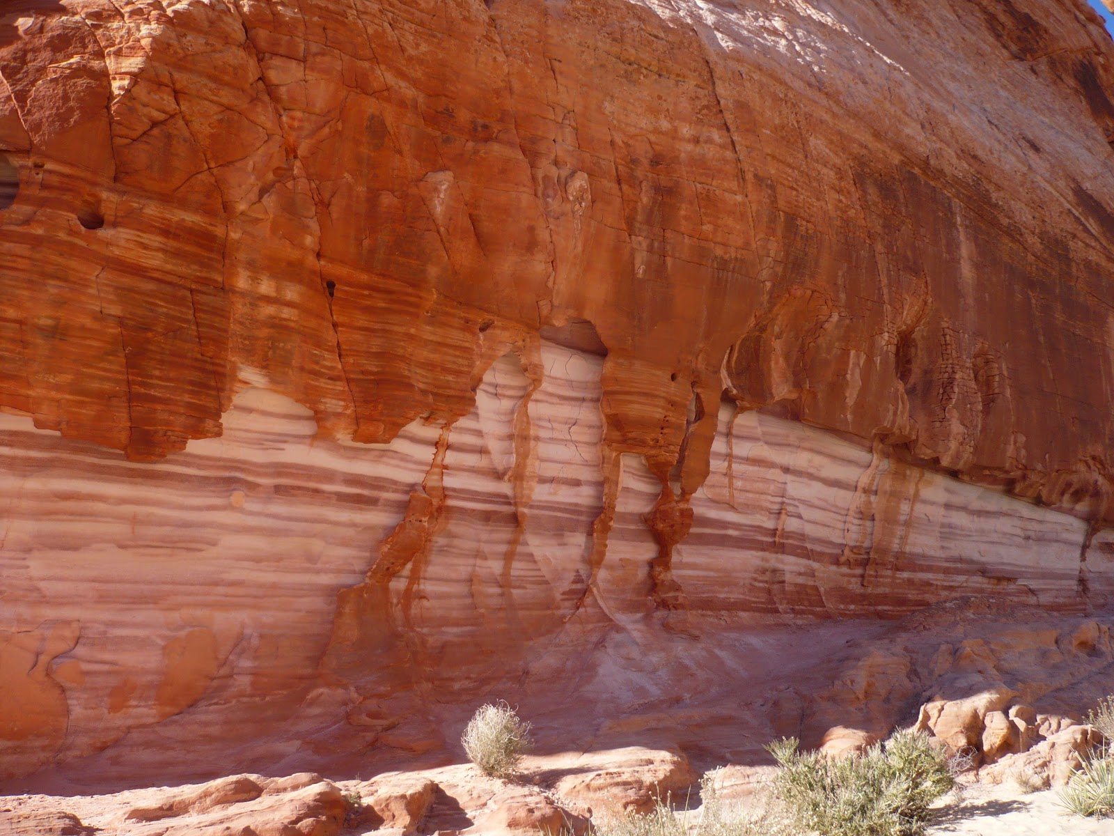
  4. We've visited Redwood NP, Whiskeytown-Shasta-Trinity NRA, Yosemite NP, Pinnacles NM, Salton Sea California State Parks), Joshua Tree NP, Death Valley NP and Mojave NP as well as various and assorted side trips—without the trailer—along the way. We explored Monterey and the 17-Mile-Drive, a WWII Air Museum in Palm Springs, a windmill farm, oases and a couple of ghost towns. George has even played golf a few times.
  5. Lots of rain in Southern California this year—even Death Valley was underwater.  
We've visited relatives, hiked and ridden our bikes, loafed around and tried to stay warm. At first we weren't staying very long at one place, but we've learned that we don't have to keep driving all the time. We don't have to be somewhere by any certain time, so we can be anywhere for as long as we want.

I'd planned on getting this blog going long before now, but playing on the computer hasn't been high on my list of things to do in retirement. We're going to be in Las Vegas for another week, so it seemed like a good time to get back to working on this.

It will be a work-in-progress for a while. Let me know if you have suggestions on places we should visit, or comments on our travels.

January 4, 2011

1/2/11 – Rhyolite Ghost Town

Rhyolite is another ghost town that popped up in the early 1900s while they were mining gold nearby, and then just as quickly died. 
We thought there was a lot of haze or dust in the air as we were driving from Pahrump to Beatty.  When we got to ­­­­Beatty, it suddenly registered that it was starting to snow! 
We decided that since we were about 5 miles from Rhyolite, we’d make a quick tour to say we’d been there.  There are actually very few buildings left.  The bank building was cool, and the old railroad station.  It was cold so we didn’t stay long.
The Goldwell Outdoor Sculpture Museum is nearby so we detoured for that, even though the snow was starting to come down in earnest.  But you have to see to believe things like the huge mosaic sofa, the huge pink and yellow lady that looks like it was built out of giant Lego blocks, the white ghost holding a bicycle (“Ghost Rider” LOL), and Szukaiski’s “Last Supper”.
Okay, we saw it.  We took pictures.  We got in the truck and high-tailed it back to Pahrump!  By morning there was about 4” of snow—just enough to have us extend one more day in Pahrump until the Spring Mountain Pass was clear before we headed to Las Vegas.